
Length 20.3 km | ||
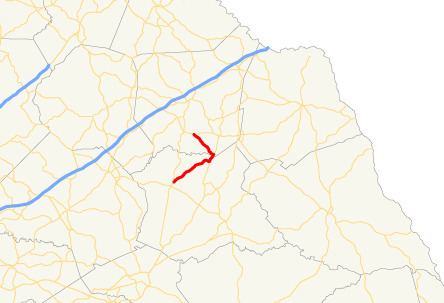 | ||
State Route 174 (SR 174) is a 12.6-mile-long (20.3 km) L-shaped state highway in the northeastern part of the U.S. state of Georgia. Its routing exists within portions of Madison and Franklin counties.
Contents
Map of State Rte 174, Martin, GA 30557, USA
Route description
SR 174 begins at an intersection with SR 106 northeast of Ila, in Madison County. It heads northeast to an intersection with US 29/SR 8, where the three highways begin a concurrency to the northeast. Just before the concurrency ends they cross the Hudson River and enter Franklin County. After entering the county, SR 174 splits off to the northwest and meets its northern terminus, an intersection with SR 51 west of Franklin Springs.
References
Georgia State Route 174 Wikipedia(Text) CC BY-SA