
Hangul 거제도 Revised Romanization Geojedo Area 383.4 km² | Hanja 巨濟島 McCune–Reischauer Kŏjedo Elevation 580 m | |
 | ||
Similar | ||
Geojedo or Geoje Island (also often spelled Koje Island) is the principal island of Geoje City, on the southern coast of Gyeongsangnam-do province, South Korea. It is joined to land by two bridges from nearby Tongyeong. Sinhyeon is the largest town on the island. The Busan-Geoje Fixed Link was open in December 2010 and provides a more direct connection to the city of Busan.
Contents
Map of Geoje-si, Gohyeon-dong, %EA%B1%B0%EC%A0%9C%EB%8F%84
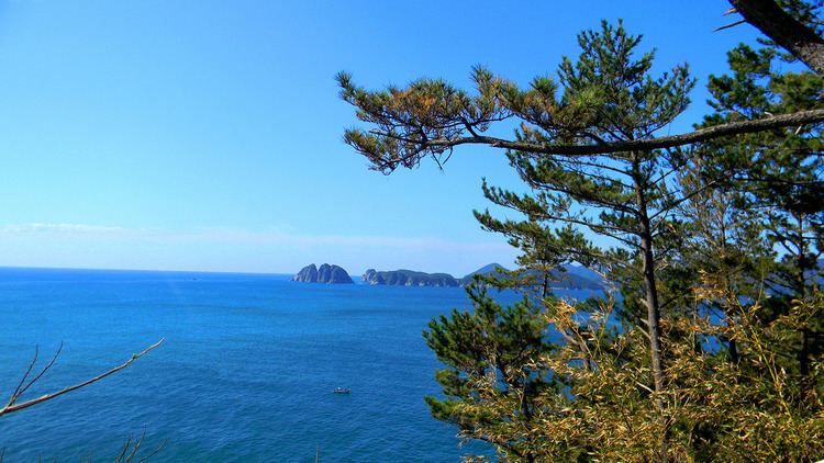
Geoje Island covers an area of 383.44 square kilometres (148.05 sq mi), the second largest island in South Korea (second to Jeju Island). The landscape features several peaks: Gara (580 metres (1,900 ft)), Gyerong (554.9 metres (1,821 ft)), the skirmisher mountain (465.5 metres (1,527 ft)), Daegeum (437.5 metres (1,435 ft)) and Googsabong (400 metres (1,300 ft)). Geojedo is known for its rich deposits of granite. The southern belt of Geojedo, together with part of Namhaedo in Namhae County, belongs to Hallyeo Maritime National Park.
Geoje Island features several natural harbors. Shipbuilding is the largest industry on the island. The second and third largest shipyards in South Korea are both located on the island, Daewoo Shipbuilding and Marine Engineering (DSME) in the city of Okpo, and Samsung Heavy Industries (SHI) in the city of Gohyeon (Geoje City).
Etymology
Geojedo (from Korean Geoje, meaning 'Great Crossing Island'; from Geo (Korean)거, (Hanja)巨 , meaning 'great, large', je (jae) (Korean)제, (Hanja)濟 , meaning 'crossing, ferry', and do (Korean)도, (Hanja)島 , meaning 'island')
History
During the Three Han States period (2300 B.C.), Geoje Island corresponded to one of the twelve states of Byeonhan (변한) state called Dokno 독로국(瀆盧國), and during the Shilla dynasty period (신라시대), King Gyeongdeok in 757 A.D. first started to use the name Geoje province "거제군" to refer to the island.
In the Korea and Joseon dynasty period, after the area called Giseong (기성현) was divided from Geoje 거제현 in 1914, the Geoje area was mistakenly called Tongyeong (통영군). During this period, the island was a strategic location between Japan and the Korean Peninsula, and therefore suffered invasion by the Japanese.
When the Japanese invaded Tongyeong in 1592, the Navy Headquarters of Three Provinces was established in Geoje which served as a command for many naval battles in the area. Included in these were the battle of May 1592; the ubiquitously famous General Lee Sunshin led Korean forces to a much celebrated naval victory at Okpo, Geoje Island (옥포해전), as well as on the 28th of July, 1592 at Gyeonnaeryang (견내량해전) also known as the Hansan Great victory(한산대첩). In the year 1597 the first and only naval defeat to the Japanese in Korean history took place at Chilcheon, Geoje (칠천량해전).
During the Korean War, UN Forces established the Geoje POW Camp in 1951 for captured North Koreans.
In 1953 Geoje province became independent, and in the early 1970s the shipbuilding industry began producing ships, and so the population grew tremendously. In 1995 Geoje finally had a large enough population to be classified as a Geoje city (거제시).
It is now becoming the location for the driving force of Korea's economic development, the shipbuilding industry.
Geoje is the hometown of the former president of Korea (1993–1998) Kim Young-sam.
It was the final port of call of the SS Meredith Victory at Christmastide 1950, when that ship evacuated some fourteen thousand North Korean civilians from Hungnam.
Geojedo was the birthplace of Chaeyeong Lee.