
Country India Established 20 February 1987 Districts 20 Area 83,743 km² | Region Northeast India Area rank 15th Capital Itanagar | |
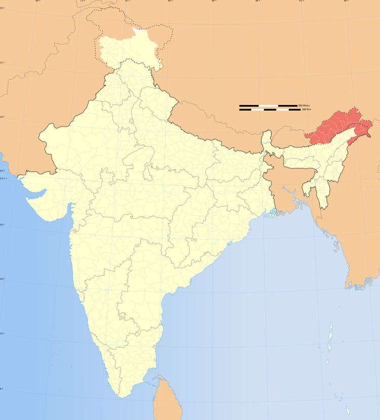 | ||
Arunachal Pradesh, also called "the land of rising sun",or orchid state of india,down-lit of mountain, lies in northeast India. The state is the largest of the North-Eastern states , spread over an area of 83,743 km2 (32,333 sq mi). The state shares an international border, 160 km (99 mi) long with Bhutan in the west while a 1,030 km (640 mi) long border separates the state from China in the north .A 440 km (270 mi) long border exosts between Arunachal Pradesh and Burma in the east.
Contents
It borders the states of Assam in the south and Nagaland in the east and southeast. Arunachal Pradesh falls in the outer Himalayas and Patkoi Ranges. It is endowed with wide topographical variations, vegetation and wild life. The state is vivisected by rivers and streams, which originate in higher Himalayas and Arakan Ranges and flow down to form the tributaries of Brahmaputra.
Arunachal Pradesh is primarily a hilly tract nestled in the foothills of Himalayas. Previously, Arunachal Pradesh had been a part of the North Eastern Frontier Agency. Today, Arunachal Pradesh is a state of the Indian Union.
Due to the topographical diversity, the climate in Arunachal Pradesh ranges from sub-tropical to temperate depending upon the altitude.The regions in the lower belts of the state experience hot and humid climates, with a maximum temperature in the foothills reaching up to 40 °C (during the summer). The average temperature in this region in winter ranges from 15° to 21 °C while that during the monsoon seasonremains between 22° and 30 °C.
The areas around the middle belt of Arunachal Pradesh are relatively cooler. The middle belt in Arunachal Pradesh experiences micro thermal climate.Moreover, Arunachal Pradesh possesses an alpine climate in the higher altitudes of the state. The higher regions of Arunachal Pradesh witness snowfall during winter. The snowfall draws large number of tourists to the state from all across the world.
Arunachal Pradesh experiences heavy rainfall during May to September. The average rainfall recorded in Arunachal Pradesh is 300 centimeters, varying between 80 centimeters and 450 centimeters.
Topography
Arunachal Pradesh is geographically divided into six natural regions. The Western parts of Kameng District and Tirap District form the first two regions of the topography of Arunachal Pradesh. The other three distinct topographical regions consist of the upper, middle and the lower belts of the state as well as the foothills. The topography of Arunachal Pradesh is characterized by mountainous ranges and sub-mountainous terrains along the northern parts. Abrasion by the rivers that flow through the mountains has created a broad valley, which is a major feature of the geography of the state.
Arunachal Pradesh is said to possess the largest area among the states in the North Eastern part of India and ranks 15th nationally. Arunachal Pradesh, which is also known as the 'Land of Dawn-Lit Mountainous', is encompassed by the Shivalik ranges. From the snow-capped mountains of the eastern Himalayas to sparsely populated mountainous areas in the extreme north-eastern part of the state, these lofty slopes form an indelible part of the area in Arunachal Pradesh.
The area in Arunachal Pradesh is divided into twenty districts, namely:
The topography in Arunachal Pradesh is characterized mainly by an undulating hilly terrain but a number of rivers also flow through the state. Dibang ,Kamla, Kameng,Kamplang, Lohit,Noa-Dihing,Siang,Siyum,Subansiri and Tirap are some of the major rivers draining the area.
Parts of the Lohit district, Changlang and Tirap district are covered by the Patkai hills. Kangto, Nyegi Kangsang, the main Gorichen peak and the Eastern Gorichen peak are some of the highest peaks in this region of the Himalayas. The land is mostly mountainous with the Himalayan ranges running north south. These divide the state into five river valleys: the Kameng, the Subansiri, the Siang, the Lohit and the Tirap. All these are fed by snow from the Himalayas and countless rivers and rivulets. The mightiest of these rivers is Siang, called the Tsangpo in Tibet, which becomes the Brahmaputra after it is joined by the Dibang and the Lohit in the plains of Assam.
At the lowest elevations, densely forested areas are seen with the trees ranging from semi-evergreen to broadleaf and semi-alpine forests.Alpine shrubs and meadows follow, ultimately leading to ice-clad peaks.
The Himalayan ranges that extend up to the eastern Arunachal separate it from Tibet. The ranges extend toward Nagaland, and form a boundary between India and Burma in Changlang and Tirap district, acting as a natural barrier called Patkai Bum Hills. They are low mountains compared to the Greater Himalayas.
Forests
At the lowest elevations, essentially at Arunachal Pradesh's border with Assam, are the Brahmaputra Valley semi-evergreen forests. Much of the state, including the Himalayan foothills and the Patkai hills, are home to Eastern Himalayan broadleaf forests. Towards the northern border with Tibet, with increasing elevation, come a mixture of Eastern and Northeastern Himalayan subalpine conifer forests followed by Eastern Himalayan alpine shrub and meadows.
The state of Arunachal Pradesh is blessed with a rich biodiversity owing to the huge expanse of green cover. The state's forests are known for housing over 5000 species of plants, 500 different birds, 85 terrestrial mammals and a wide number of insects, butterflies and reptiles.Apart from them, the forests of Arunachal are also home to a large number of people belonging to the different tribes .These tribal people, aloof from urbanization, dwell in these forests where the various forest-based products form a part of their livelihood.
Climatically, the forests can be categorised as Tropical and Sub-tropical forests, Temperate forest, Pine forests and Subalpine forest.
Biodiversity
Owing to its location amid the foothills of the Himalayas, Arunachal Pradesh is one of the richest states in the region in terms of biodiversity.The state's climatic conditions facilitate the growth of a vast variety of plants and trees in the territory, thereby providing a rich store of fauna to the region.
Orchids, fern, bamboo, cane, rhododendrons, oak, hedychiums, and various medicinal plants form a diverse range of the state's green cover.
Apart from housing a myriad of plants and trees, Arunachal is also home to various different species of animals which add to its rich biodiversity.