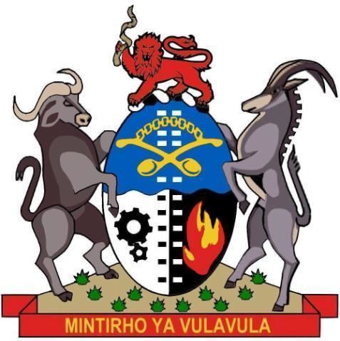
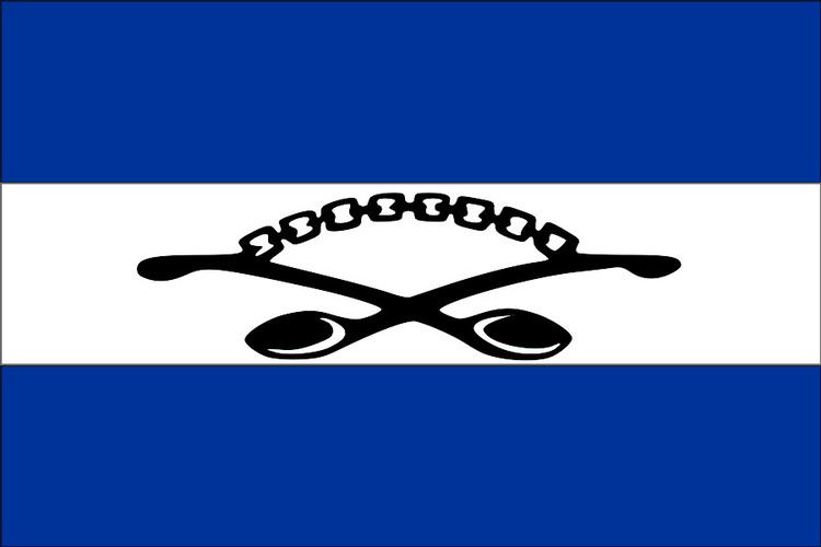
Flag Coat of arms Re-integrated into South Africa April 27, 1994 Founded 1971 Government Bantustan | Languages TsongaEnglish Self-government 1971 Area 7,730 km² Date dissolved 1994 | |
 | ||
Chief Minister Hudson Ntsanwisi (1971-1993)Edward Mhinga(1993)Samuel Nxumalo (1993-1994) | ||
Gazankulu
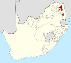
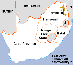
Gazankulu was a bantustan in South Africa, intended by the apartheid government to be a semi-independent homeland for the Shangaan Tsonga people. It was located in both the Northern Transvaal, now Limpopo province and Eastern Transvaal, now Mpumalanga province. It received self-rule from the central government in 1969, with its capital at Giyani. Gazankulu homeland covered the lands around Elim Hospital, which is 15 km from Makhado town, as well as some areas around Levubu river valley, the villages of Valdezia and Bungeni being the two largest Tsonga settlements in the Levubu river valley, with a combined population of more than 50 000 people, according to the mid-2015 population statistics and stretched down up to Hazyview in Mpumalanga. Total length of Gazankulu, from Elim Hospital to Hazyview, was 317 km long, which is a distance equivalent of travelling from Pretoria to Bandelierkop in Limpopo. The homeland consisted of the 'Mainland Gazankulu' which were Elim, Giyani and Malamulele, with 3 large exclaves, which were Bushbuckridge, Tzaneen and Phalaborwa. Gazankulu shared borders with other black homelands, which were, Venda, Lebowa and Kangwane.
Contents
- Gazankulu
- Belafonte paradise in gazankulu live 1987
- Gazankulu today
- Districts in 1991
- Gazankulu lost kingdoms
- References
Belafonte paradise in gazankulu live 1987
Gazankulu today
Gazankulu, as a political entity, no longer exists, it is today part of Limpopo and Mpumalanga provinces. In 1994, Gazankulu was sub-divided into different municipalities cross-cutting linguistic and cultural boundaries, a feature of a new democratic South Africa. The western district of former Hlanganani was allocated to Makhado Local Municipality (130 000 people), the southern part of Hlanganani was divided and allocated to Greater Letaba Local Municipality (45 000 people), while the eastern part of Hlanganani was allocated to Greater Giyani Local Municipality (35 000 people). In total, Hlanganani district lost 80 000 people to both the Greater Giyani and Greater Letaba local Municipalities in 1994, while Makhado local municipality was the biggest beneficiary of the former Hlanganani district, it took more than 130 000 people from the former Hlanganani in 1994 when the district was broken-up. The Greater Giyani Local Municipality was merged with some parts of Bolobedu (Northern Sotho speaking), Malamulele was merged with Thulamela Local Municipality and Lulekani was merged with Namakgale to form a new Municipality with Phalaborwa known as Ba-Phalaborwa Local Municipality. Shiluvane, under Hosi Muhlaba and other Tsonga areas in Ritavi has been merged to form Greater Tzaneen Local Municipality. In Bushbuckridge, the whole area has been merged with Northern Sotho and the Swazi to form Bushbuckridge Local Municipality. East of Hazyview, Mkhuhlu and other areas around Hoxane have been merged with Tshabalala tribal authority (Swazi) to form Mbombela Local Municipality. So in 1994, Gazankulu has been divided into 8 large local municipalities, totalling 1.7 million Tsonga speakers, who mixed with the Swazi, the Venda and the Northern Sotho to form diverse communities with others South Africans, an ideal that former President Nelson Mandela fought for during his lifetime.
The population of the former Gazankulu, according to the 2011 census, is spread out as follows; Limpopo 1.1 million or 17% of the province, Mpumalanga 500 000 or 11.5% of the province and Gauteng 800 000 or 4% of the province. Total population is 2,3 million or 5% of South Africa's population. All the Tsonga people working and schooling in Gauteng comes from Gazankulu, so the 800 000 Tsonga people in Gauteng have their homes in Gazankulu, it can therefore be assumed that when these Tsonga people return to Limpopo and Mpumalanga during Easter and December holidays, the Tsonga population in both Limpopo and Mpumalanga rises sharply.
Districts in 1991
Districts of the homeland and population in the 1991 census.
Gazankulu lost kingdoms
The Tsonga Kingdoms in the southern, central and northern Kruger National Park are home to South Africa's big five game, before the creation of South Africa's biggest game reserve (Kruger National Park), the entire land, equivalent in size to the State of Israel, was controlled by the Tsonga people. These 'Tsonga lands' were taken from the control of the Tsonga people and annexed to colonial South Africa between 1890 and 1926. From Skukuza, Manyeleti in the southern Kruger, Klaserie, Timbavati in the central Kruger and Makuleke in the Pafuri triangle in the northern Kruger are all Tsonga lands taken during colonial times. All these areas are part of Gazankulu but were considered white areas during the apartheid years. Luxurious game reserve in the Tsonga land are Protea Hotel Kruger gate (5-Star), Ulusaba game reserve (5-Star), Singita game reserve (5-Star), Londolozi game reserve (5-star), Skukuza rest camp (5-Star), Satara game reserve (5-star), Leopard Hill (5-star), Sabi Sand Game Reserve game reserve (5-Star) and many more. These game reserves were considered part of white South Africa, but historically, they are all Tsonga country. The above luxurious game reserves are world-class, tourist from all over the world visit them annually, Ulusaba and Skukuza have the largest concentration of Africa's big five, they are both served by Skukuza Airport. While game reserves such as Timbavati and Manyeleti in Central Kruger are served by Eastgate Airport in Hoedspruit. The Tsonga people, who used to control the whole park before colonization, are now active participants in Tourism, they are mainly employed in the game reserves, including the Protea Hotel Kruger gate in Hazyview.