
Time zone SAST (UTC+2) Area 10,250 km² Black african population 99.5% | Wards 37 Municipal code MP325 White population 0.2% Native sotho speakers 5.4% | |
 | ||
Points of interest Elephant Point, Manyeleti Game Reserve, Ndzhaka Camp, Honeyguide Mantobeni Camp | ||
Bushbuckridge Local Municipality is a third-level administrative division in the Ehlanzeni District of Mpumalanga in South Africa. Tobacco, cotton and vegetables are farmed in the municipality's countryside. The municipality includes part of Kruger National Park. It is the biggest local municipality in Mpumalanga, in terms of land mass and by population.
Contents
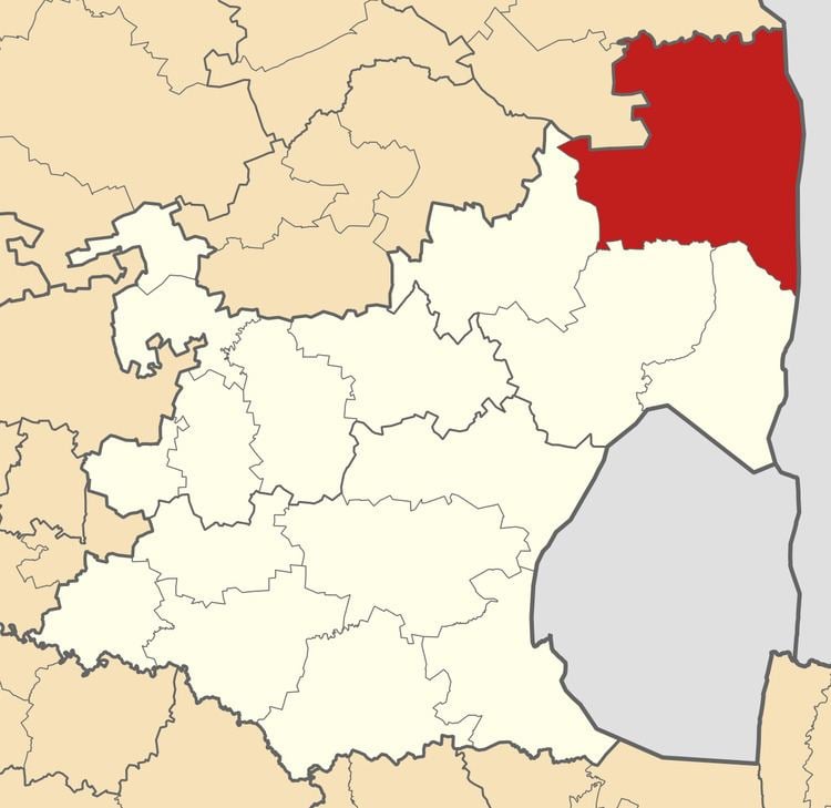
- Map of Bushbuckridge South Africa
- History
- 1995 1996 Protest
- Geography
- Demographics
- Administrative subdivisions
- Main places
- Politics
- References
Map of Bushbuckridge, South Africa
History
The name Bushbuck Ridge was given because of the large herds of bushbuck found there in the 1880s, and the prominent WNW-ESE ridge in the southeastern part of the municipality. The town of Bushbuckridge grew around a trading store that opened in 1884. Prior to the colonial and apartheid era, the land known today as Bushbuckridge was known as Mapulaneng, it has been home to the Mapulana people for centuries before the Tsonga and the Swazi invaded the area. Mapulaneng was replaced during the white conquest and named Bushhbuckridge by British and Boer Colonialists.
1995-1996 Protest
In 1994, when the Transvaal Province was dismantled and divided into four Provinces, the area from Bushbuckridge to Hazyview was included in Limpopo province. The decision was based on the fact that most of the Bushbuckridge area had been part of three separate bantustans — Gazankulu, Lebowa and KaNgwane — but the bigger sector fell within Gazankulu, which was incorporated into Limpopo. The citizens of Bushbuckridge became embroiled in a dispute with the government, demanding inclusion of the area in Mpumalanga province. They were concerned that should the area be included into Limpopo, they would be marginalised and suffer poor service delivery since Polokwane, the Capital city of Limpopo Province, is more than 300 km away, whereas Nelspruit, the capital of Mpumalanga is 58 km away. For more than two years the government refused to allow Bushbuckridge to fall under Mpumalanga, leading to violent protests and resistance from the community, which included stay-aways, road blockage with burning tyres and destruction of property.
A decision was taken at Cabinet level in 1998 to transfer the area to Mpumalanga. However, the area was not transferred to Mpumalanga until 2000 when President Thabo Mbeki and his Cabinet amended the Constitution and legally handed over Bushbuckridge to Mpumalanga. However, because of red tape it was not until 2005 that Bushbuckridge was officially transferred to Mpumalanga.
Geography
Bushbuckridge is bounded by Mopani District Municipality of Limpopo Province to the north, by Mozambique to the east, by Mbombela Local Municipality and Nkomazi Local Municipality to the south, and by Thaba Chweu Local Municipality and Maruleng Local Municipality to the west.
The 2013 proposal to adjust the border between the municipal area of Mbombela Local Municipality (MP322) and Bushbuckridge Local Municipality (MP325) was approved for implementation in 2016.
Demographics
The population of the municipality in the 2011 census was 541,248. The principal first language is Tsonga (57%), followed by Northern Sotho with about 25%.
Administrative subdivisions
Bushbuckridge Local Municipality consists of 135 settlements and is divided into thirty-seven wards.
Main places
The 2001 census divided the municipality into the following main places:
Politics
The municipal council consists of seventy-four members elected by mixed-member proportional representation. Thirty-seven councillors are elected by first-past-the-post voting in thirty-seven wards, while the remaining thirty-seven are chosen from party lists so that the total number of party representatives is proportional to the number of votes received. In the election of 18 May 2011 the African National Congress (ANC) won a majority of fifty-five seats on the council. The following table shows the results of the election.