
Elevation 7,134 m Prominence 1,709 m | Easiest route snow/ice climb First ascent 8 May 1979 Mountain range Himalayas Listing Ultra-prominent peak | |
 | ||
Similar Melungtse, Dorje Lhakpa, Pumori, Gyachung Kang, Cho Oyu | ||
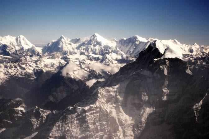
Mount gaurishankar and mt melungtse from mountain flight
Gaurishankar (also Gauri Sankar or Gauri Shankar; Devanagari गौरीशंकर; Tibetan: Jomo Tseringma;) is a mountain in the Himalayas, the second highest peak of the Rolwaling Himal, behind Melungtse (7,181m). The name comes from the Hindu goddess Gauri, a manifestation of Durga, and her Consort Shankar, denoting the sacred regard to which is afforded it by the peoples of Tibet and Nepal. The Buddhist Sherpas call the mountain Jomo Tseringma. The Nepal Standard Time (GMT+05:45) is based on the meridian of this mountain peak.
Contents
- Mount gaurishankar and mt melungtse from mountain flight
- Map of Gauri Sankar 45500 Nepal
- LocationEdit
- Notable featuresEdit
- Climbing historyEdit
- References
Map of Gauri Sankar, 45500, Nepal
LocationEdit
Gaurishankar lies near the western edge of the Rolwaling Himal, about 100 kilometres (62 mi) northeast of Kathmandu. (It is almost directly between Kathmandu and Mount Everest, and is visible from Kathmandu.) To the west of the peak lies the valley of the Bhote Kosi, the western boundary of the Rolwaling Himal. To the north lies the Menlung Chu, which separates it from its sister peak Melungtse. To the south lies the Rolwaling Chu, which leads up to the Tesi Lapcha pass, giving access to the Khumbu region. It is in Dolakha District.
Notable featuresEdit
The mountain has two summits, the northern (higher) summit being called Shankar (a manifestation of Shiva) and the southern summit being called Gauri (a manifestation of Shiva's consort). It rises dramatically above the Bhote Kosi only 5 km away, and is protected on all sides by steep faces and long, corniced ridges.
Climbing historyEdit
The first attempts to climb Gauri Sankar were made in the 1950s and 1960s but weather, avalanches and difficult ice faces defeated all parties. From 1965 until 1979, the mountain was officially closed for climbing. When permission was finally granted in 1979, an American-Nepalese expedition finally managed to gain the top, via the West Face. This was a route of extreme technical difficulty. The permit from the Nepalese Ministry of Tourism stipulated that the summit could only be reached if an equal number of climbers from both nations were on the summit team. John Roskelley and Dorje Sherpa fulfilled that obligation.
In the same year, a British-Nepalese expedition led by Peter Boardman climbed the long and difficult Southwest Ridge. Boardman, Tim Leach, Guy Neidhardt, and Pemba Lama made it to the south "Gauri" summit (7010m. ) on November 8, 1979. Though they did not make the long additional traverse to the main "Shankar" summit, their climb was a significant achievement in itself.
In 1983 Gaurishankar was reached again by a Slovenian team. The main summit (7134m) was reached on November 1 by Slavko Cankar (expedition leader), Bojan Šrot and Smiljan Smodiš; and three days later by Franco Pepevnik and Jože Zupan. They climbed the left side of the South Face to reach the Southwest Ridge, then continuing to the main summit.
The Himalayan Index lists only two additional ascents of the main summit of Gauri Sankar. The second ascent was made in the spring of 1984 by Wyman Culbreth and Ang Kami Sherpa, via a new route on a ridge on the southwest face. The third ascent (and the first winter ascent), in January 1986, was by South Korean Choi Han-Jo and Ang Kami Sherpa.
In the fall of 2013, the complete south face was finally climbed by a four-man team of French climbers. After reaching the top of the south face at 4 pm on October 21, they decided not to continue to the 7,010 m south summit. It took them 11 hours to descend to the bottom of the face.