
Country Canada | Province Québec | |
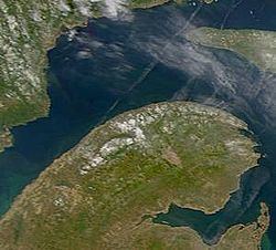 | ||
The gasp sie or gasp peninsula
The Gaspésie (official name), or Gaspé Peninsula, the Gaspé or Gaspesia, is a peninsula along the south shore of the Saint Lawrence River to the east of the Matapédia Valley in Quebec, Canada, that extends into the Gulf of Saint Lawrence. It is separated from New Brunswick on its southern side by the Baie des Chaleurs (Chaleur Bay) and the Restigouche River.
Contents
- The gasp sie or gasp peninsula
- Map of Peninsule de la Gaspesie Mont Albert QC Canada
- Route 132 coastal drive part 1 gaspe peninsula quebec
- Geography
- Inland
- History
- Economy
- Tourism
- Roads
- References
Map of Peninsule de la Gaspesie, Mont-Albert, QC, Canada
The origin of the name "Gaspé" comes from the Mi'kmaq word gespe'g, meaning "end", referring to the end of the land. A Basque linguist has instead suggested "Gaspé" comes from a mutation of the Basque word "geizpe", meaning "shelter", however this view is disputed.
The Gaspé Peninsula is slightly larger than Belgium, at 31,075 square kilometres (11,998 sq mi). The population is 140,599 as of the 2011 census.
Route 132 coastal drive part 1 gaspe peninsula quebec
Geography
Sea cliffs dominate the peninsula's northern shore along the St. Lawrence River. Cap Gaspé, jutting into the Gulf of St. Lawrence, is the easternmost point of the peninsula. Percé Rock (or Rocher Percé), an island pierced by a natural arch, is located just offshore of the peninsula's eastern end. The peninsula's interior is a rugged northward continuation of the Appalachian Mountains called the Chic-Chocs, with Mont Jacques-Cartier at 1,268 metres (4,160 ft) the peninisula's highest peak.
Mount Albert (Mont Albert) at 1,151 m (3,776 ft) is another high mountain in the Chic-Chocs. Its summit, an alpine area above the tree line, is a nearly flat plateau about 13 km (8 mi) across composed of serpentine bedrock and supporting a quite unusual flora. The ascent of Mount Albert from near sea level is challenging, but popular with hikers, offering a view of the St. Lawrence and the Côte-Nord, the river's north shore, part of the ancient bedrock of the Canadian Shield.
Inland
The interior portions of the peninsula are dominated by the Chic-Choc Mountains, part of the Notre Dame Mountains, an extension of the Appalachian Mountains.
The town of Murdochville, at about 660 metres (2,170 ft) above sea level, has had a varied history, and is now home to several wind turbines. It is reached by Route 198, which extends inland from the northern shore of the peninsula, soon climbing into the mountains and entering vast forests, crossing several small rivers before reaching the town. From Murdochville, Route 198 follows the York River to the city of Gaspé on the peninsula's eastern tip.
History
Expelled from Acadia, some exiles fled to nearby Gaspe in 1775.
Economy
The economy of the peninsula has historically been focused on fishing, agriculture and forestry. However, primary resource based industries are suffering due to overfishing, overexploitation and fewer numbers of farmers in business, forcing the region to move towards tourism and the services industry.
Tourism
The peninsula is one of Quebec's most popular tourism regions. The Gaspé National Park (Parc national de la Gaspésie) is located in the Chic-Chocs, and Forillon National Park is at the peninsula's northeastern tip. A section of the International Appalachian Trail travels through the peninsula's mountains. Bonaventure National Park is located here. .