
Length 100 km (62 mi) Type of rock Limestone | Elevation 2,770 m (9,090 ft) Orogeny Alpine orogeny | |
 | ||
Mountains | ||
The Gailtal Alps (German: Gailtaler Alpen or Drauzug), is a mountain range of the Southern Limestone Alps in Austria. It rises between the River Drava (Drau) and the Gail valley (in southwestern Carinthia) and through the southern part of East Tyrol. Its western group called "Lienz Dolomites" (Lienzer Dolomiten), is sometimes counted as part of this range and sometimes seen as separate.
Contents
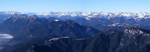
- Map of Gailtaler Alpen 9640 Austria
- ClassificationEdit
- GeographyEdit
- Neighbouring rangesEdit
- SubdivisionsEdit
- LiteratureEdit
- References
Map of Gailtaler Alpen, 9640, Austria
ClassificationEdit
According to the Alpine Club classification of the Eastern Alps (AVE) the Gailtal Alps (No. 56) are subdivided into the Drauzug proper and Lienz Dolomites subgroups, while in common parlance the umbrella term Drauzug conversely applies to the whole Limestone Alps range between the Drava and Gail rivers, including the Gailtal Alps and the Lienz Dolomites. In traditional geography according to Eduard Suess and Leopold Kober, Drauzug or Drau-Save-Zug denoted all Southern Limestone Alps ranges stretching along the Drava River, from the Lienz Dolomites in the west to the Karawanks in the east.
Located south of the broad Drava Valley, the Gailtal Alps orographically count as part of the Southern Limestone Alps. However, they rise north of the Periadriatic Seam an therefore geologically do not rank among the Southern Alps ranges. In regard to their orogenesis, they represent the remnants of the limestone nappes which had been moved northwards across the Central Eastern Alps to form the Northern Limestone Alps.
Despite their name, the Lienz Dolomites are not made up of dolostone, though the steep rugged karst topography resembles the South Alpine Dolomite rock formations. The northern Latschur group with Mt. Goldeck near Spittal an der Drau does not consist of limestone rocks, but is a crystalline basement massif.
GeographyEdit
The 100 km long range, which narrows in the west, stretches between the Gail in the south and the Drava in the north. In a trough between the Gailtal Alps and Mt. Goldeck lies the Weißensee at 930 metres (3,050 ft), the highest lake for bathing in Austria.
Neighbouring rangesEdit
Based on the AVE classification, the adjacent ranges are:
SubdivisionsEdit
The Gailtal Alps can be divided into five massifs in east-west direction, separated by draws and the Weissensee longitudinal valley: