
Prominence 2,043 ft (623 m) Elevation 2,116 m | State/Province US-NV Topo map USGS Gass Peak | |
 | ||
Similar Harris Mountain, Hayford Peak, McFarland Peak, Mormon Peak, Mount Wilson | ||
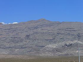
Gass Peak is the highest peak in the Las Vegas Range of Southern Nevada. It is easily seen to the north of the Las Vegas Valley, bordering the city of North Las Vegas. The peak is located about 20 miles north of Las Vegas and is within the Desert National Wildlife Refuge, administered by the U.S. Fish & Wildlife Service.
Map of Gass Peak, Nevada 89025, USA
Gass Peak is accessible by the public and the most common access is via the Corn Creek Station off U.S. Route 95, northwest of Las Vegas. Roads are dirt roads and hiking trails are not maintained. A communications tower with solar panels has been built at the top of the peak.
Gass Peak is named for Octavius Decatur Gass (1828–1924), an early settler and prominent rancher of Las Vegas.
References
Gass Peak Wikipedia(Text) CC BY-SA