
Topo map USGS Freel Peak Prominence 959 m | Elevation 3,318 m | |
 | ||
Similar Jobs Peak, Mount Tallac, Pyramid Peak, Leavitt Peak, Mount Morgan | ||
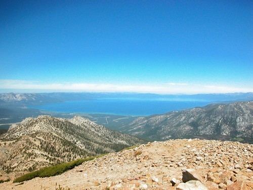
Freel Peak is a mountain located in the Carson Range, a spur of the Sierra Nevada, near Lake Tahoe in California.
Map of Freel Peak, California 96150, USA
The peak is on the boundary between El Dorado County and Alpine County; and the boundary between the Eldorado National Forest and the Humboldt-Toiyabe National Forest. At 10,886 feet (3,318 m) it is the tallest summit in the Carson Range, El Dorado County and the Tahoe Basin. Due to its elevation, most of the precipitation that falls on the mountain is snow.
In 1893, the U.S. Geological Survey assigned the name Freel Peak to what was then known as Jobs Peak. James Freel was an early settler in the area.
References
Freel Peak Wikipedia(Text) CC BY-SA