
Topo map USGS Emerald Bay Prominence 212 m Easiest route Hiking | Elevation 2,968 m Mountain range Sierra Nevada Parent range Sierra Nevada | |
 | ||
Listing Tahoe OGUL Peak ListSierra Peaks Section Similar Pyramid Peak, Freel Peak, Ralston Peak, Maggies Peaks, Rubicon Peak | ||
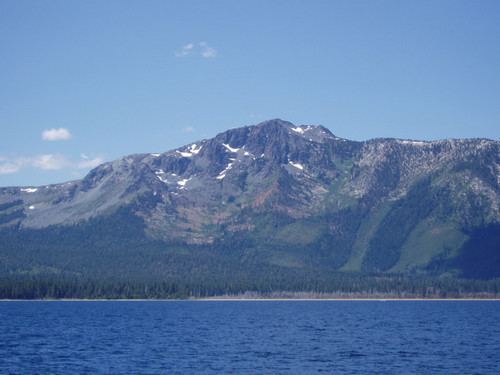
Mount Tallac is a mountain peak southwest of Lake Tahoe, in El Dorado County, California. The peak lies within the Desolation Wilderness in the Eldorado National Forest. It is quite visible from State Routes 89 and 28, and U.S. Route 50. A "cross of snow" is clearly visible on the mountain's face during the winter, spring, and early summer months.
Map of Mt Tallac, California 96150, USA
The mountain is shown on maps of the Whitney Survey as Chrystal Peak. In 1877, the Wheeler Survey named the peak "Tallac", after the Washo word "daláʔak", meaning 'big mountain'.
An estimated 10,000 climb the peak each year via routes approaching the summit from Desolation Wilderness to the west, Fallen Leaf Lake to the East, and access roads from the north. Wilderness permits are required to hike Mount Tallac.
The opening sequence of the TV series Bonanza was filmed at the McFaul Creek Meadow, with Mount Tallac in the background.