
Established 1793 Designated 1923 Phone +1 416-392-6907 | Website fortyork.ca | |
 | ||
Official name Fort York Heritage Conservation District Address 250 Fort York Blvd, Toronto, ON M5V 3K9, Canada Hours Open today · 10AM–4PMWednesday10AM–4PMThursday10AM–4PMFriday10AM–4PMSaturday10AM–5PMSunday10AM–5PMMonday10AM–4PMTuesday10AM–4PM Similar Ontario Science Centre, Garrison Common, Royal Ontario Museum, Centreville Amusement Park, Art Gallery of Ontario Profiles | ||
Canada day dominion day 2016 at fort york
Fort York is a historic site of military fortifications and related buildings on the west side of downtown Toronto, Ontario, Canada. The fort was built by the British Army and Canadian militia troops in the late 18th and early 19th centuries, to defend the settlement and the new capital of the Upper Canada region from the threat of a military attack, principally from the newly independent United States. It was designated a National Historic Site of Canada in 1923. The City of Toronto designated the site, along with the nearby Fort York Armoury, as a Heritage Conservation District in 1985.
Contents
- Canada day dominion day 2016 at fort york
- Toronto historic fort york canada hd travel channel
- Founding
- Buildings
- The War of 1812 and after
- Artillery
- Units
- Fort York National Historic Site
- Fort York Armoury
- Affiliations
- Bridges
- Fort York Pedestrian and Cycle Bridge
- References
Toronto historic fort york canada hd travel channel
Founding
In 1793, Lieutenant Governor John Graves Simcoe authorized a garrison on the present site of Fort York, just west of the mouth of Garrison Creek on the north western shore of Lake Ontario. Simcoe recognized Toronto was an ideal site for settlement and defence because of its natural harbour and relative longer distance from the United States. Fort York guards the western (at the time of construction, the only) entrance to the bay. Simcoe had decided to make Toronto (which he renamed York) the capital of Upper Canada, and the government, the first parliament buildings and the town were established one and a half miles east of the fort (near the foot of the present Parliament Street).
Buildings
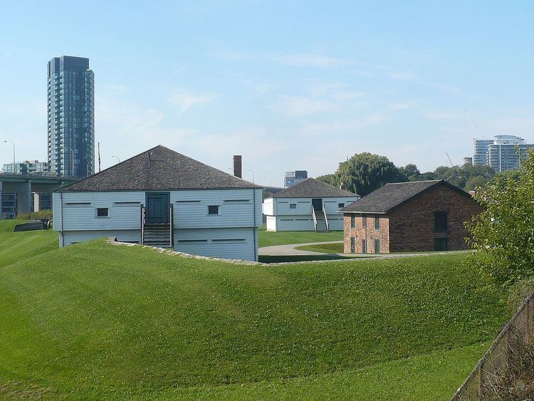
In 1797 a garrison was built east of modern-day Bathurst Street, on the east bank of Garrison Creek. This fort was destroyed in the Battle of York, 1813 (see below). Today's Fort York was largely built by Royal Engineers immediately after the War of 1812. The rebuilt Fort York is located on the original fort site west of Bathurst, at the time on the west bank of Garrison Creek. Fort York's buildings are among the oldest buildings in Toronto today. The original fort buildings were all wood, whereas the current structures are a mix of brick and wood.
A list of current structures at the fort:
Additional buildings located outside the fort were mainly star shaped blockhouses or magazines:
The War of 1812 and after
During the War of 1812, on April 27, 1813, U.S. army and naval forces attacked York from Lake Ontario, overrunning the garrison (see Battle of York). As the British abandoned the fort, they set the powder magazine to blow up, killing or wounding several hundred U.S. soldiers (including General Zebulon Pike, for whom Pikes Peak is named). The explosion was heard as far away as Fort George, rivalled only by an explosion of black powder the British set off when they were unable to bring with them said powder in their retreat from Corunna under Moore around the same time in the Napoleonic campaign in Europe. The U.S. destroyed what was left of the garrison and burned much of the settlement of York, including the Parliament Buildings during their five-day occupation. They had defeated outnumbered British, Canadian, and First Nations forces, but with the loss of many more men. Following several more U.S. raids over the summer, the British garrison returned to York and rebuilt the fortifications, most of which are still standing today. The rebuilt fort was sufficient to repel a further attempted invasion in 1814.
The British Army had occupied Fort York from 1793 but transferred the site to the Dominion of Canada after Confederation, which used the site until 1932. However, the City of Toronto owned Fort York from 1903 onwards.
Fort York was used as a military establishment until 1880, and again during the First and Second World Wars.
Artillery
Fort York was defended by cannons on the west, north and south:
Units
British
Canadian Regulars and Militia
Fort York National Historic Site
Fort York National Historic Site houses Canada's largest collection of original War of 1812 period buildings. The fort, operated as a museum of the City of Toronto, offers casual visitors and booked groups a number of exciting services year round. During the summer months, the site comes alive with the colour and the pageantry of the Fort York Guard and is complimented with tours by professional historical interpreters. In the off-season months, the fort is busy providing educational programs for booked tour groups including school, scout, guide, and day care groups.
In the 1950s Fort York was almost torn down to make way for the Gardiner Expressway, but Highway planners eventually rerouted the elevated highway to the south of the grounds.
The reclaimed lands to the south of the fort are in the process of being developed, with new condo towers eventually limiting any possible reconnection with Lake Ontario. The cemetery for the fort was located west of the garrison and overgrown with grass and thistles, no effort was made to keep it in good condition. By the late 19th century twenty eight stones or wooden crosses marked graves, but there were hundreds of mounds. The cemetery continued to fall into disrepair and is not part of the present Fort York.
From 1995 to 2008, Fort York hosted Toronto's annual Festival of Beer.
On 28 June 1985 Canada Post issued 'Fort York, Ont, circa 1816.', one of the 20 stamps in the "Forts Across Canada Series" (1983 & 1985).
Fort York Armoury
Southwest of Fort York is the Fort York Armoury, a two-storey structure built in 1933 with private funds. Designed by Toronto architects Marani, Lawson and Morris, it has the largest lattice wood arched roof in Canada.
It is occupied by the Canadian Forces Primary Reserve, the Queen's York Rangers, the Royal Regiment of Canada, and the 32 Signals Regiment (formerly 709 (Toronto) Communication Regiment). It used to be the home of 2 Field Engineer Regiment, the Toronto Scottish Regiment (Queen Elizabeth the Queen Mother's Own), the 48th Highlanders of Canada, and the 1st Battalion Irish Regiment. In addition to being the headquarters of the three active units of the Army Reserve, the armoury is also home to several thriving cadet organizations.
Affiliations
The Museum is affiliated with: the Canadian Museums Association, the Canadian Heritage Information Network, and Virtual Museum of Canada.
Bridges
There are two bridges at the fort:
Fort York Pedestrian and Cycle Bridge
A two span pedestrian and bicycle bridge is being built to connect Fort York with Stanley Park. Completion of the bridge is planned for 2017. It will be built with stainless steel by Dufferin Construction Company.
The bridge will result two new parks being created: South Stanley Park Extension and Ordnance Triangle Park.