
Area 2,709 km² Population 9,126 (2013) Unemployment rate 8.4% (Apr 2015) | Website www.co.forest.wi.gov Founded 1848 | |
 | ||
Points of interest Camp Five Museum, Lake Lucerne, Potawatomi Bingo Northern, Forest County Veterans, Franklin & Butternut Lakes Sta | ||
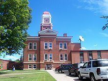
Forest County is a county in the U.S. state of Wisconsin. As of the 2010 census, the population was 9,304. Its county seat is Crandon.
Contents
- Map of Forest County WI USA
- History
- Geography
- Adjacent counties
- Airport
- National protected area
- Demographics
- City
- Census designated places
- Ghost towns
- References
Map of Forest County, WI, USA
The Forest County Potawatomi Community and the Sokaogon Chippewa Community have reservations in Forest County.
History
Forest County was created by the Wisconsin State Legislature in 1885 from portions of neighboring Langlade and Oconto counties. The county was named for the forests contained within its limits.
Geography
According to the U.S. Census Bureau, the county has a total area of 1,046 square miles (2,710 km2), of which 1,014 square miles (2,630 km2) is land and 32 square miles (83 km2) (3.1%) is water.
Adjacent counties
Airport
National protected area
Demographics
As of the census of 2000, there were 10,024 people, 4,043 households, and 2,769 families residing in the county. The population density was 10 people per square mile (4/km²). There were 8,322 housing units at an average density of 8 per square mile (3/km²). The racial makeup of the county was 85.86% White, 11.30% Native American, 1.18% Black or African American, 0.17% Asian, 0.04% Pacific Islander, 0.23% from other races, and 1.22% from two or more races. 1.08% of the population were Hispanic or Latino of any race. 34.3% were of German, 11.4% Polish, 7.4% Irish and 5.4% American ancestry according to Census 2000. 95.5% spoke English, 1.4% Spanish and 1.0% Potawatomi as their first language.
Out of the 4,043 households, 29.20% have children under the age of 18, 54.00% have a married couple living together, 9.80% had a female householder with no husband present, and 31.50% were non-families. 28.20% of all households were made up of individuals living alone, and 13.20%, of individuals of 65 years of age or older living alone. The average household size was 2.39 and the average family size was 2.89.
The age distribution in the county's population is as follows: 25.30% under the age of 18, 7.80% from 18 to 24, 23.90% from 25 to 44, 23.80% from 45 to 64, and 19.30% 65 years of age or older. The median age is 40 years. For every 100 females there were 100.20 males. For every 100 females age 18 and over, there were 99.00 males.