
Area 1,290 km² Population 4,520 (2013) | Founded 1882 Unemployment rate 7.0% (Apr 2015) | |
 | ||
Website www.florencecountywi.com Points of interest | ||
Florence County is a county located in the U.S. state of Wisconsin. As of the 2010 census, the population was 4,423, making it the second-least populous county in Wisconsin. Its county seat is Florence.
Contents
- Map of Florence County WI USA
- History
- Geography
- Adjacent counties
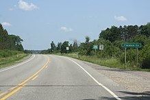
- Major highways
- National protected area
- Demographics
- Communities
- Census designated places
- References
Map of Florence County, WI, USA
Florence County is part of the Iron Mountain, MI–WI Micropolitan Statistical Area.
History
Florence County was founded in 1882. Florence County takes its name from the Florence Mining Company.
Geography
According to the U.S. Census Bureau, the county has a total area of 498 square miles (1,290 km2), of which 488 square miles (1,260 km2) is land and 9.3 square miles (24 km2) (1.9%) is water.
Adjacent counties
Major highways
National protected area
Demographics
As of the census of 2000, there were 5,088 people, 2,133 households, and 1,441 families residing in the county. The population density was 10 people per square mile (4/km²). There were 4,239 housing units at an average density of 9 per square mile (3/km²). The racial makeup of the county was 98.17% White, 0.16% Black or African American, 0.43% Native American, 0.28% Asian, 0.02% Pacific Islander, 0.14% from other races, and 0.81% from two or more races. 0.45% of the population were Hispanic or Latino of any race. 25.6% were of German, 11.6% Swedish, 8.4% Polish, 8.2% Italian, 6.6% French, 5.9% English, 5.4% French Canadian and 5.2% Irish ancestry.
There were 2,133 households out of which 27.50% had children under the age of 18 living with them, 58.60% were married couples living together, 6.00% had a female householder with no husband present, and 32.40% were non-families. 27.90% of all households were made up of individuals and 12.50% had someone living alone who was 65 years of age or older. The average household size was 2.35 and the average family size was 2.87.
In the county, the population was spread out with 22.90% under the age of 18, 5.30% from 18 to 24, 27.10% from 25 to 44, 27.30% from 45 to 64, and 17.50% who were 65 years of age or older. The median age was 42 years. For every 100 females there were 104.30 males. For every 100 females age 18 and over, there were 101.50 males.
Communities
Florence County is one of only two counties in Wisconsin with no incorporated communities, the other being Menominee County.