
Named for John Floyd Founded 1800 | Area 1,026 km² Population 38,728 (2013) | |
 | ||
Website www.floydcountykentucky.com Rivers Levisa Fork, Johns Creek, Rock Fork, Mare Creek Colleges and Universities Big Sandy Community and Technical College, Regency School of Hair Design Points of interest Jenny Wiley State Resort Pa, Dewey Lake, Middle Creek Battlefield, Archer Park | ||
Floyd County is a county located in the U.S. state of Kentucky. As of the 2010 census, the population was 39,451. Its county seat is Prestonsburg. The county, founded in 1800, is named for Colonel John Floyd (1750–1783).
Contents
- Map of Floyd County KY USA
- History
- Geography
- Adjacent counties
- Demographics
- Education
- Coal companies in Floyd County
- Politics
- Cities
- Census designated places
- Other unincorporated places
- Notable natives
- References
Map of Floyd County, KY, USA
History
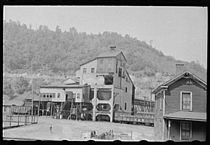
On December 13, 1799, the Kentucky General Assembly passed legislation to form Floyd County as the 40th county of Kentucky. The county was made from parts of Fleming, Montgomery, and Mason County, Kentucky. The legislation became effective on June 1, 1800. The county was named for James John Floyd, a pioneer surveyor who helped lay out the city of Louisville. The county seat was Preston's Station, later renamed Prestonsburg. The first court house burned down on April 8, 1808, destroying all the early records, so the earliest records of government activity do not date prior to 1808. Prestonsburg was used as a Confederate stronghold during the Civil War and two battles took place nearby, the Battle of Ivy Mountain on November 8, 1861 and the Battle of Middle Creek on January 10, 1862. Both were Union victories. In 1958, the county was the site of one of the deadliest bus accidents in U.S. history.
Geography
According to the U.S. Census Bureau, the county has a total area of 396 square miles (1,030 km2), of which 393 square miles (1,020 km2) is land and 2.4 square miles (6.2 km2) (0.6%) is water.
Adjacent counties
Demographics
As of the 2010 United States Census, there were 39,451 people residing in the county. 98.2% were White, 0.7% Black or African American, 0.2% Asian, 0.1% Native American, 0.2% of some other race and 0.6% of two or more races. 0.6% were Hispanic or Latino (of any race).
As of the census of 2000, there were 42,441 people, 16,881 households, and 12,272 families residing in the county. The population density was 108 per square mile (42/km2). There were 18,551 housing units at an average density of 47 per square mile (18/km2). The racial makeup of the county was 97.73% White, 1.29% Black or African American, 0.12% Native American, 0.24% Asian, 0.08% Pacific Islander, 0.12% from other races, and 0.42% from two or more races. 0.61% of the population were Hispanic or Latino of any race. The Kentucky Melungeons live primarily in Floyd and Magoffin counties, especially in a valley known as Big Lick in Floyd County.
There were 16,881 households out of which 33.00% had children under the age of 18 living with them, 56.50% were married couples living together, 12.30% had a female householder with no husband present, and 27.30% were non-families. 25.20% of all households were made up of individuals and 10.20% had someone living alone who was 65 years of age or older. The average household size was 2.45 and the average family size was 2.93.
In the county, the population was spread out with 23.60% under the age of 18, 9.40% from 18 to 24, 30.30% from 25 to 44, 24.50% from 45 to 64, and 12.20% who were 65 years of age or older. The median age was 37 years. For every 100 females there were 96.70 males. For every 100 females age 18 and over, there were 95.00 males.
The median income for a household in the county was $21,168, and the median income for a family was $25,717. Males had a median income of $30,242 versus $20,569 for females. The per capita income for the county was $12,442. About 26.90% of families and 30.30% of the population were below the poverty line, including 39.80% of those under age 18 and 20.50% of those age 65 or over.
Education
The county's public schools are operated by the Floyd County School District.
Coal companies in Floyd County
Politics
Floyd County is traditionally a Democratic county. The county gave Bill Clinton over 65% in both 1992 and 1996 while George W. Bush never received more than 38% of the county's vote. In 2008 its votes went to the Republican Party's presidential candidate for the first time since in the county's history. It is part of Kentucky's 5th congressional district, which has been represented by Republican Hal Rogers since 1981.