
Country United States Time zone Eastern (EST) (UTC-5) Elevation 201 m Population 617 (2013) Area code 606 | Incorporated 1920 FIPS code 21-50286 Zip code 41649 Local time Monday 7:50 PM | |
 | ||
Weather 11°C, Wind NW at 10 km/h, 37% Humidity Area 194 ha (189 ha Land / 5 ha Water) | ||
Martin is a 4th-class city in Floyd County, Kentucky, in the United States. The population was 634 as of the 2010 census.
Contents
Map of Martin, KY, USA
Geography
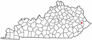
Martin is located near the center of Floyd County at 37°34′4″N 82°45′34″W (37.567791, -82.759465). Kentucky Routes 80 and 122 run along the western side of the city. KY 80 leads southwest 41 miles (66 km) to Hazard and north 5 miles (8 km) to U.S. Route 23 at a point 3 miles (5 km) south of Prestonsburg, the county seat. KY 122 leads northwest by a narrower road 11 miles (18 km) to Prestonsburg and south 4 miles (6 km) to Printer.
According to the United States Census Bureau, the city of Martin has a total area of 0.75 square miles (1.95 km2), of which 0.02 square miles (0.05 km2), or 2.67%, is water. Beaver Creek, a tributary of the Levisa Fork, flows northward through the center of Martin.
Government
Martin uses a mayor-council form of government. The current mayor is Sam Howell. The representative body of the city of Martin is the city council. The council members include: Gary Akers, Bobby Dingus, April Gayheart, Charles Justice, Eulene Ratliff, and James (Jim) Reynolds.
Education
Martin's public schools are operated by Floyd County Schools. The following schools are in Martin:
Demographics
As of the census of 2000, there were 633 people, 295 households, and 166 families residing in the city. The population density was 1,357.5 people per square mile (520.0/km²). There were 339 housing units at an average density of 727.0 per square mile (278.5/km²). The racial makeup of the city was 97.31% White, 0.32% Native American, 1.11% Asian, 1.11% Pacific Islander, and 0.16% from two or more races. Hispanic or Latino of any race were 0.95% of the population.
There were 295 households out of which 28.8% had children under the age of 18 living with them, 31.2% were married couples living together, 21.7% had a female householder with no husband present, and 43.4% were non-families. 40.3% of all households were made up of individuals and 17.6% had someone living alone who was 65 years of age or older. The average household size was 2.08 and the average family size was 2.81.
In the city, the population was spread out with 24.6% under the age of 18, 8.2% from 18 to 24, 24.6% from 25 to 44, 25.8% from 45 to 64, and 16.7% who were 65 years of age or older. The median age was 38 years. For every 100 females there were 77.8 males. For every 100 females age 18 and over, there were 72.2 males.
The median income for a household in the city was $12,917, and the median income for a family was $18,571. Males had a median income of $35,469 versus $19,167 for females. The per capita income for the city was $10,773. About 46.1% of families and 44.0% of the population were below the poverty line, including 64.8% of those under age 18 and 19.5% of those age 65 or over.