
Established February 22, 1897 Address Montana 59911, USA | Nearest city Kalispell, MT Governing body U.S. Forest Service Phone +1 406-758-5208 | |
 | ||
Area 2,404,935 acres (9,732.43 km) Website Flathead National Forest Hours Closed today SundayClosedMonday8AM–4:30PMTuesday8AM–4:30PMWednesday8AM–4:30PMThursday8AM–4:30PMFriday8AM–4:30PMSaturdayClosed Management United States Forest Service Similar US Forest Services Ranger S, Wayfarers Campgro, Outback Montana RV Park Profiles | ||
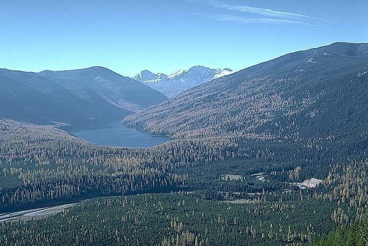
Wayward passage backcountry adventures upper chain lake flathead national forest
The Flathead National Forest is a national forest in the western part of the U.S. state of Montana. The forest covers 2,404,935 acres (3,758 sq mi; 9,732 km2) of which about 1 million acres (4,000 km2) is designated wilderness. It is named after the Flathead Native Americans who lived in the area. The forest is located in the Rocky Mountains with elevations ranging from 4,500 to 8,500 feet (1,400 to 2,600 m). The forest provides habitat for approximately 250 species of wildlife and 22 species of fish. This includes the threatened grizzly bear, Canadian lynx, bald eagle, bull trout, a rare plant named water howellia, and the endangered gray wolf.
Contents
- Wayward passage backcountry adventures upper chain lake flathead national forest
- Future of wild lands flathead national forest
- References
The Flathead National Forest is bordered by Glacier National Park and Canada to the north, the Lewis and Clark National Forest and Glacier to the east, the Lolo National Forest to the south, and the Kootenai National Forest to the west. The wilderness areas in the forest are the Bob Marshall Wilderness Area, Great Bear Wilderness Area, and Mission Mountains Wilderness Area. Other specially-designated areas in the forest include Flathead Wild and Scenic River, Jewel Basin Hiking Area, and the Coram Experimental Forest. Some 270,000 acres (1,100 km2) of non-federal land are also included in the boundaries drawn for the national forest. This includes private land, commercial forest and part or all of Swan River State Forest, Stillwater State Forest and Coal Creek State Forest.
Commercial activities in the non-wilderness sections of the forest include timber harvesting, two downhill ski resorts and a small amount of cattle grazing. Individuals can pick less than 10 US gallons (38 l) of berries without a permit. Larger amounts of berries, firewood and Christmas tree cutting, and mushroom or mineral gathering in wilderness areas require permits.
The forest contains 1,700 miles (2,700 km) of roads, many of them primitive fire roads and 2,800 miles (4,500 km) of hiking trails.
Approximately 38 miles (61 km) of the Pacific Northwest National Scenic Trail are located within the Flathead National Forest.
While camping is allowed almost anywhere within national forests without a permit, Flathead National Forest also has 34 campgrounds with some facilities. The largest campground has only 40 sites and 2 campgrounds have only one site each. Most campgrounds do not have running water. There are also 11 cabins for rent in the forest.
The forest lies primarily in Flathead County (about 73% of its acreage), but smaller areas extend into five other counties. In descending order of land area they are Powell, Missoula, Lake, Lewis and Clark, and Lincoln counties. Forest headquarters are located in Kalispell, Montana. There are local ranger district offices in Bigfork, Hungry Horse, and Whitefish.