
Founded 1901 | Congressional district At-large Area 6,042 km² Population 6,993 (2013) Cities Deer Lodge | |
 | ||
Website www.powellcountymt.gov/ez/index.php Rivers Gold Creek, Blackfoot River, Ophir Creek, Racetrack Creek Points of interest | ||
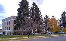
Powell County is a county located in the U.S. state of Montana. As of the 2010 census, the population was 7,027. Its county seat is Deer Lodge.
Contents
- Map of Powell County MT USA
- Geography
- Major highways
- Adjacent counties
- National protected areas
- 2000 census
- 2010 census
- Government and infrastructure
- City
- Census designated places
- Unincorporated communities
- References
Map of Powell County, MT, USA
Geography
According to the U.S. Census Bureau, the county has a total area of 2,333 square miles (6,040 km2), of which 2,326 square miles (6,020 km2) is land and 6.3 square miles (16 km2) (0.3%) is water.
Major highways
Adjacent counties
National protected areas
2000 census
As of the census of 2000, there were 7,180 people, 2,422 households, and 1,634 families residing in the county. The population density was 3 people per square mile (1/km²). There were 2,930 housing units at an average density of 1 per square mile (0/km²). The racial makeup of the county was 92.52% White, 0.50% Black or African American, 3.51% Native American, 0.43% Asian, 0.74% from other races, and 2.30% from two or more races. 1.95% of the population were Hispanic or Latino of any race. 25.0% were of German, 13.6% Irish, 9.7% English, 7.4% American and 5.8% Norwegian ancestry.
There were 2,422 households out of which 29.50% had children under the age of 18 living with them, 55.50% were married couples living together, 7.70% had a female householder with no husband present, and 32.50% were non-families. 28.60% of all households were made up of individuals and 13.30% had someone living alone who was 65 years of age or older. The average household size was 2.39 and the average family size was 2.93.
In the county, the population was spread out with 21.20% under the age of 18, 7.80% from 18 to 24, 30.80% from 25 to 44, 26.20% from 45 to 64, and 14.00% who were 65 years of age or older. The median age was 40 years. For every 100 females there were 143.20 males. For every 100 females age 18 and over, there were 151.40 males.
The median income for a household in the county was $30,625, and the median income for a family was $35,836. Males had a median income of $26,366 versus $20,457 for females. The per capita income for the county was $13,816. About 10.20% of families and 12.60% of the population were below the poverty line, including 16.20% of those under age 18 and 6.00% of those age 65 or over.
2010 census
As of the 2010 United States Census, there were 7,027 people, 2,466 households, and 1,582 families residing in the county. The population density was 3.0 inhabitants per square mile (1.2/km2). There were 3,105 housing units at an average density of 1.3 per square mile (0.50/km2). The racial makeup of the county was 92.4% white, 4.4% American Indian, 1.0% black or African American, 0.5% Asian, 0.4% from other races, and 1.3% from two or more races. Those of Hispanic or Latino origin made up 1.7% of the population. In terms of ancestry, 27.9% were German, 19.1% were Irish, 14.6% were English, 8.5% were Norwegian, and 4.7% were American.
Of the 2,466 households, 26.5% had children under the age of 18 living with them, 50.8% were married couples living together, 8.8% had a female householder with no husband present, 35.8% were non-families, and 32.2% of all households were made up of individuals. The average household size was 2.23 and the average family size was 2.79. The median age was 45.1 years.
The median income for a household in the county was $39,851 and the median income for a family was $45,339. Males had a median income of $30,163 versus $24,837 for females. The per capita income for the county was $17,849. About 12.3% of families and 17.3% of the population were below the poverty line, including 32.4% of those under age 18 and 13.0% of those age 65 or over.
Government and infrastructure
The current Montana State Prison facility is located in an unincorporated area in the county, near Deer Lodge.