
Reference no. DE: 1412 | ||
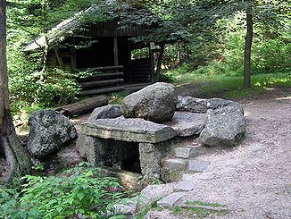 | ||
Main source on the southeastern slopes of the Ochsenkopfca. 865 m | ||
The Fichtelnaab is a right-hand, western headstream of the River Naab in Upper Franconia and the Upper Palatinate. It rises in the Fichtelgebirge and flows into the Waldnaab near Windischeschenbach.
Contents
Map of Fichtelnaab, Germany
CourseEdit
The source of the Fichtelnaab is located on the southeastern slope of the Ochsenkopf (1,024 m above sea level (NN)) northwest of Fichtelberg and west of the Fichtelsee (10.5 hectares and 752 m above NN). From there it flows southeast through the villages of Fichtelberg and Mehlmeisel in the district of Tirschenreuth. From there the Fichtelnaab passes through Brand, Ebnath, Neusorg and Erbendorf to Windischeschenbach, where it joins the Waldnaab.
TributariesEdit
References
Fichtelnaab Wikipedia(Text) CC BY-SA