Time zone CET (UTC+1) Number of municipalities 24 | Area 278.3 km² | |
 | ||
Points of interest Schattenburg, Wildpark Feldkirch, Furkajoch, Drei Schwestern, Katzenturm Destinations | ||
The Bezirk Feldkirch is an administrative district (Bezirk) in Vorarlberg, Austria.
Contents
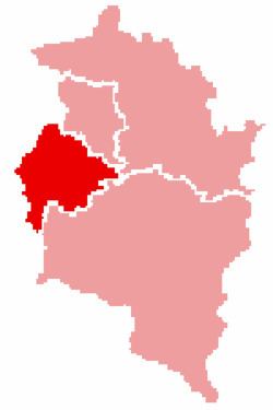
Map of Feldkirch District, Austria
Area of the district is 278.26 km², population is 100,656 (2012), and population density 362 persons per km². Administrative center of the district is Feldkirch.
Administrative divisions
The district is divided into 24 municipalities, one of them is a town, and three of them are market towns.
Towns
- Feldkirch (31,054)
Market towns
- Frastanz (6,274)
- Götzis (10,795)
- Rankweil (11,635)
Municipalities
- Altach (6,397)
- Düns (377)
- Dünserberg (147)
- Fraxern (677)
- Göfis (3,083)
- Klaus (3,102)
- Koblach (4,269)
- Laterns (678)
- Mäder (3,739)
- Meiningen (2,035)
- Röns (314)
- Röthis (1,922)
- Satteins (2,590)
- Schlins (2,271)
- Schnifis (762)
- Sulz (2,390)
- Übersaxen (629)
- Viktorsberg (389)
- Weiler (2,022)
- Zwischenwasser (3,105)
(population numbers as of January 1, 2012)
References
Feldkirch District Wikipedia(Text) CC BY-SA
