
Website www.lexingtonky.gov Founded 1780 Unemployment rate 3.6% (Apr 2015) | Largest city Lexington Area 740.7 km² Population 308,428 (2013) | |
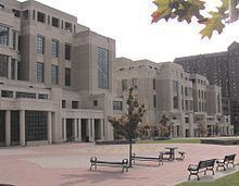 | ||
Cities Cardinal Valley, Lexington, Zandale, Lexington, Brigadoon, Lexington, Eastland, Lexington Colleges and Universities University of Kentucky, Transylvania University, Bluegrass Community and Tech, University of Kentucky College o, Lexington Theological Seminary | ||
The talbott house farm lexington fayette county kentucky
Fayette County is a county located in the U.S. Commonwealth of Kentucky. As of the 2010 census, the population was 295,803, making it the second-most populous county in Kentucky. Its territory, population and government are coextensive with the city of Lexington, which also serves as county seat.
Contents
- The talbott house farm lexington fayette county kentucky
- Map of Fayette County KY USA
- Red state bbq on u s 25 in fayette county kentucky
- History
- Geography
- Adjacent counties
- Demographics
- Public high schools
- Private middle and elementary schools
- Private high schools
- City
- Historically black hamlets
- References
Map of Fayette County, KY, USA
Fayette County is part of the Lexington–Fayette, KY Metropolitan Statistical Area.
Red state bbq on u s 25 in fayette county kentucky
History
Fayette County was one of the original three counties created from the former Kentucky County, Virginia, by the Virginia Act in 1780, along with Jefferson and Lincoln counties. Together they separated from Virginia in 1792 to become the Commonwealth of Kentucky.
Originally, Fayette County included land which makes up 37 present-day counties and portions of 7 others. It was reduced to its present boundaries in 1799. The county is named for the Marquis de LaFayette, who came to America to join the rebelling English colonies in the American Revolutionary War.
On January 1, 1974, Fayette County merged its government with that of its county seat of Lexington, creating a consolidated city-county governed by the Lexington-Fayette Urban County Government.
Geography
According to the U.S. Census Bureau, the county has a total area of 286 square miles (740 km2), of which 284 square miles (740 km2) is land and 1.9 square miles (4.9 km2) (0.7%) is water.
Adjacent counties
Demographics
As of the census of 2000, there were 260,512 people, 108,288 households, and 62,915 families residing in the county. The population density was 916 people per square mile (354/km²). There were 116,167 housing units at an average density of 408 per square mile (158/km²). The racial makeup of the county was 81.04% White, 13.48% Black or African American, 0.19% Native American, 2.46% Asian, 0.03% Pacific Islander, 1.21% from other races, and 1.58% from two or more races. 3.29% of the population were Hispanic or Latino of any race.
There were 108,288 households out of which 27.30% had children under the age of 18 living with them, 43.50% were married couples living together, 11.50% had a female householder with no husband present, and 41.90% were non-families. 31.70% of all households were made up of individuals and 7.50% had someone living alone who was 65 years of age or older. The average household size was 2.29 and the average family size was 2.90.
In the county, the population was spread out with 21.30% under the age of 18, 14.60% from 18 to 24, 33.20% from 25 to 44, 20.90% from 45 to 64, and 10.00% who were 65 years of age or older. The median age was 33 years. For every 100 females there were 96.50 males. For every 100 females age 18 and over, there were 94.30 males.
The median income for a household in the county was $39,813, and the median income for a family was $53,264. Males had a median income of $36,166 versus $26,964 for females. The per capita income for the county was $23,109. About 8.20% of families and 12.90% of the population were below the poverty line, including 14.30% of those under age 18 and 8.60% of those age 65 or over.
Public high schools
Schools in the county are operated by Fayette County Public Schools.