
Population 37,882 (2015 Est) Mayor Liz Innes Area 3,428 km² | Established 1913 Website Eurobodalla Shire Founded 1913 | |
 | ||
Points of interest Mogo Zoo, The Original Gold Rus, Murramarang National Park, Montague Island, Birdland Animal Park Destinations | ||
Eurobodalla Shire is a local government area located in the South Coast region of New South Wales, Australia. The Shire is located in a largely mountainous coastal region and situated adjacent to the Tasman Sea, the Princes Highway and the Kings Highway.
Contents
- Map of Eurobodalla NSW Australia
- Towns and localities
- History
- Economy
- Demographics
- Age distribution
- Nation of birth
- Languages spoken at home
- Religion
- Housing
- Household motor vehicle ownership
- Housing tenure
- Structure of inhabited dwellings
- Employment
- Current composition and election method
- References
Map of Eurobodalla, NSW, Australia
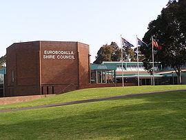
The Mayor of Eurobodalla Shire Council is Cr. Liz Innes, an unaligned politician.
Towns and localities
The shire chambers are located in the town of Moruya in the central part of the Shire. Other major towns within the shire include Batemans Bay and Narooma. Smaller towns and hamlets include Durras, Nelligen, Mogo, Malua Bay, Tomakin, Broulee, Mossy Point, Rosedale, Bodalla, Potato Point, Nerrigundah, Mystery Bay, Central Tilba, Wallaga Lake Koori Village and Congo.
History
The area which is now Eurobodalla Shire was originally the home of the South Coast Bugelli-Manji and Yuin Aboriginal peoples. The Council signed a Commitment to Indigenous Australians and a Local Agreement with the Aboriginal Community.
The Eurobodalla Shire Council was formed in 1913 with the responsibility for administering local government functions along 110 kilometres (68 mi) of the NSW coast between Durras and Wallaga Lake. The Council administers only about 30% of the area of the Shire as the remaining 70% is non-rateable crown land held as national park and state forest: 40% of the shire is national park, 30% is state forest, 20% is productive farmland and 10% is urban settlement.
The Shire is unusual in that nearly half of ratepayers are non-residents. Just over 17% of ratepayers are residents of Canberra. Although the permanent population is around 34,100, the visiting population (who stay more than 3 nights) is 3.1 million per year.
Economy
The main growth industries in the area are construction, government services, real estate, retail, retirement, aged care, tourism, while dairy farming, forestry, sawmilling and commercial fishing are traditional industries in decline. Eurobodalla Shire is serviced by two highways - the Princes Highway between Sydney and Melbourne (part of Highway One around Australia), and the Kings Highway (National Route 52) linking Batemans Bay to Canberra. Moruya Airport, just east of the township of Moruya, is serviced by regular scheduled commuter flights to Sydney and Melbourne. There are no railways or major seaports in Eurobodalla Shire.
Demographics
In the 2011 census, the Local Government Area of Eurobodalla recorded a population of 35,741 people. The area of 3,422 square kilometre gives a population density 9.8 people per square kilometre.
Age distribution
Nation of birth
Languages spoken at home
Religion
Housing
Household motor vehicle ownership
Housing tenure
Structure of inhabited dwellings
Employment
Current composition and election method
Eurobodalla Shire Council is composed of nine Councillors, including the Mayor, for a fixed four-year term of office. The Mayor is directly elected while the eight other Councillors are elected proportionally as one entire ward. The most recent election was held on 10 September 2016, and the makeup of the Council, including the Mayor, is as follows:
The current Council, elected in 2016, in order of election, is: