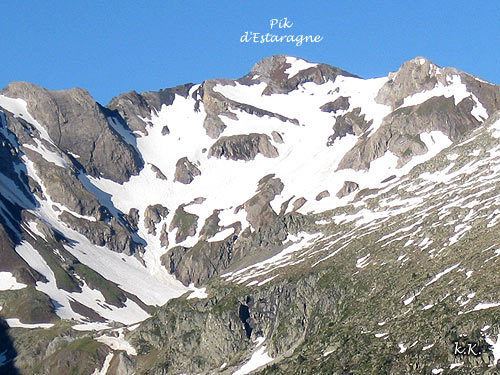
Elevation 3,006 m | ||
 | ||
Similar Campbieil, Néouvielle massif, Pic Long, Pic Badet, Pic Ramougn | ||
The Estaragne (Pic d'Estaragne) is a French pyrenean summit, culminating at 3,006 m (9,862 ft) m.
Contents
Map of Estaragne, 65170 Aragnouet, France
TopographyEdit
The peak is located in the Hautes-Pyrénées department, in the Néouvielle massif, near Saint-Lary-Soulan in the Pyrenees National Park and near the Néouvielle National Nature Reserve.
HistoryEdit
The etymology of the name "Estaragne" is obscure, although there is a small valley and stream with the same name just to the northeast of the peak.
EcologyEdit
The peak itself is bare, but the upper slopes have a sub-alpine climate. Meadows predominate with patches of trees and shrubs. Snow cover usually starts in late October and lasts until June. the most common shrubs are Rhododendron ferrugineum and Vaccinium myrtillus; and the most common grasses are Nardus stricta and Festuca eskia.
AccessEdit
There are at least two relatively easy summer access routes:
