
Canton Vielle-Aure Population 1,073 (2006) | Region Occitanie Area 90.97 km (35.12 sq mi) Local time Tuesday 10:23 PM | |
 | ||
Weather 8°C, Wind SW at 3 km/h, 77% Humidity Points of interest Altiservice Saint‑Lary, Lac d'Aubert, Maison de l'Ours, Lac de l'Oule, Pic de Néouvielle | ||
Saint-Lary-Soulan is a commune in the Hautes-Pyrénées department in south-western France.
Contents
Map of 65170 Saint-Lary-Soulan, France
Geography
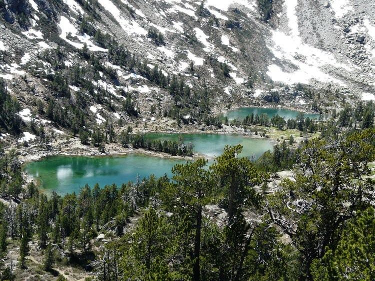
Saint-Lary is located in Hautes-Pyrénées 80 km south of the département's capital Tarbes, next to the Le Néouvielle Nature Reserve and the Pyrenees National Park and is a 20-minute drive to Spain.
Skiing
Saint-Lary-Soulan is one of the largest ski resorts in the French Pyrenees with over 100 km of downhill slopes. There are 53 pistes spread over three linked, and yet distinct sectors. Saint Lary 1700 is known as the Pla d'Adet sector and provides family skiing including snow kindergarten, toboggan run and a 'Kidpark', a snowpark aimed at young skiers aged between 6 and 12 years. Saint Lary 1900 is known as the Espiaube sector and is frequented by more experienced skiers. The showpiece ski run is the Mirabelle which descends 700 metres over its 3.6 km (2.2 mi) length. Saint Lary 2400 has a snowpark which doubles as a skate park in the summer, mogul and slalom stadiums and also provides access to Lake Oule for snow-shoeing.
Hiking
Saint-Lary-Soulan is also a popular base camp for walkers. The coast to coast GR10 footpath passes through Saint-Lary itself and both the Pyrenees National Park and The Néouvielle Nature Reserve are close by.
Cycling
The Tour de France frequently runs through Saint-Lary-Soulan, most recently in 2005 and is close to a number of mountain climbs used on the tour including the Pla d'Adet, Col d'Aspin, Col de Peyresourde and Col du Tourmalet. Stage 17 of the 2014 Tour de France finishes on the Pla d'Adet, above the commune.