
Area 5,491 km² Population 1,884 (2013) Unemployment rate 3.7% (Apr 2015) | Founded 1883 Cities Rocksprings | |
 | ||
Website www.edwardscountytexas.us Rivers Nueces River, Pulliam Creek, Hackberry Creek | ||
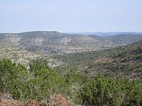
10600 acre rocksprings hunting ranch in edwards county texas
Edwards County is a county located on the Edwards Plateau in the U.S. state of Texas. As of the 2010 census, its population was 2,002. The county seat is Rocksprings. The county was created in 1858 and later organized in 1883. It is named for Haden Edwards, an early settler of Nacogdoches, Texas. The Edwards Aquifer and Edwards Plateau are named after the county by reason of their locations.
Contents
- 10600 acre rocksprings hunting ranch in edwards county texas
- Map of Edwards County TX USA
- Rancho buena suerte for sale 452 acres edwards county texas
- History
- Geography
- Major highways
- Adjacent counties
- Demographics
- Town
- Unincorporated communities
- References
Map of Edwards County, TX, USA
Rancho buena suerte for sale 452 acres edwards county texas
History
Geography
According to the U.S. Census Bureau, the county has a total area of 2,120 square miles (5,500 km2), of which 2,118 square miles (5,490 km2) is land and 2.0 square miles (5.2 km2) (0.09%) is water.
Major highways
Adjacent counties
Demographics
As of the census of 2000, there were 2,162 people, 801 households, and 586 families residing in the county. The population density was less than 1/km² (1/sq mi). There were 1,217 housing units at an average density of 1 per square mile (0/km²). The racial makeup of the county was 83.26% White, 0.79% Black or African American, 0.79% Native American, 0.14% Asian, 12.72% from other races, and 2.31% from two or more races. 45.05% of the population were Hispanic or Latino of any race.
There were 801 households out of which 31.70% had children under the age of 18 living with them, 60.80% were married couples living together, 8.90% had a female householder with no husband present, and 26.80% were non-families. 24.70% of all households were made up of individuals and 13.50% had someone living alone who was 65 years of age or older. The average household size was 2.66 and the average family size was 3.20.
In the county, the population was spread out with 28.50% under the age of 18, 6.50% from 18 to 24, 23.20% from 25 to 44, 25.70% from 45 to 64, and 16.20% who were 65 years of age or older. The median age was 39 years. For every 100 females there were 102.60 males. For every 100 females age 18 and over, there were 98.20 males.
The median income for a household in the county was $25,298, and the median income for a family was $27,083. Males had a median income of $21,912 versus $14,907 for females. The per capita income for the county was $12,691. About 24.60% of families and 31.60% of the population were below the poverty line, including 47.40% of those under age 18 and 17.70% of those age 65 or over.