
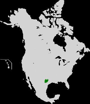
Country United States Habitat loss 5.35% Bird species 191 | State Texas Protected 2.26% Mammal species 64 | |
 | ||
Keep texas wild edwards plateau texas parks and wildlife official
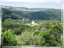
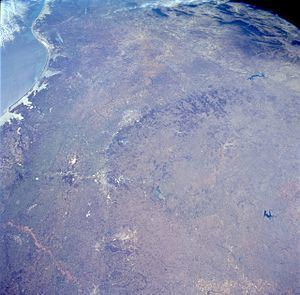
The Edwards Plateau is a region of west-central Texas which is bounded by the Balcones Fault to the south and east, the Llano Uplift and the Llano Estacado to the north, and the Pecos River and Chihuahuan Desert to the west. San Angelo, Austin, San Antonio and Del Rio roughly outline the area. The eastern portion of the plateau is known as the Texas Hill Country.
Contents
- Keep texas wild edwards plateau texas parks and wildlife official
- Counties in the Edwards Plateau
- Natural history
- Human history
- References
Counties in the Edwards Plateau
According to the Texas Parks and Wildlife Department, the following 41 counties comprise the Edwards Plateau:
Natural history
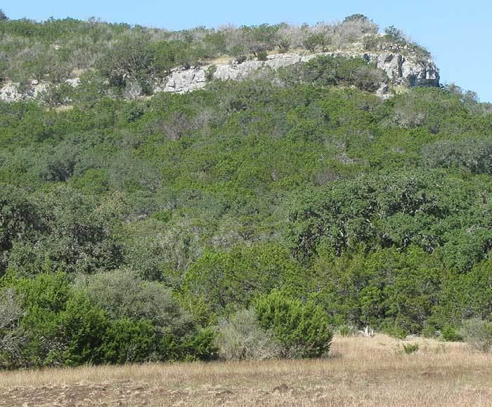
The bedrock consists primarily of limestone, with elevations ranging between 100 and 3000 ft. Caves are numerous.
The landscape of the plateau is mostly savanna scattered with trees. It mostly lacks deep soil suitable for farming, though the soil is fertile mollisols and some cotton, grain sorghum and oats are grown. For the most part, though, the thin soil and rough terrain areas are primarily grazing regions, with cattle, sheep and Angora goats predominant. Several rivers cross the region, which generally flow to the south and east through the Texas Hill Country toward the Gulf of Mexico; springs occur (in wet years), but permanent surface water supplies are sparse throughout the area, except for man-made reservoirs. The area is well drained; rainwater flows into the Edwards Aquifer recharge zone at the south of the plateau to feed rivers to the south. Rainfall varies from 15 to 33 inches per year, on average, from northwest to southeast, and the area has a moderate temperature and a reasonably long growing season.
Trees of the savanna include a juniper-oak mix and a mesquite-acacia mix scattered over fairly short grasses, which traditionally were affected by droughts and regular fires. Some pecan trees are found near the springs and rivers. The Balcones Fault is associated with the Edwards Plateau formation. This fault line is an ecological demarcation for the range definition of a number of species. For example, the California fan palm, Washingtonia filifera, is known to occur only west of the Edwards Plateau or Balcones Fault, and Buddleja racemosa is known only from the southern edge of the plateau.
Caves of the Edwards Plateau are important habitats for a great deal of wildlife. The area is home to some of the largest colonies of bats in the world, including millions of Mexican free-tailed bats. The largest colony of these inhabits Bracken Cave near San Antonio, while the Congress Avenue Bridge in Austin is the summer home for over half a million (they winter in Mexico) and is the largest bat colony anywhere in an urban area. There are also large numbers of reptiles and birds, including breeding populations of the Texan endemic golden-cheeked warbler (Dendroica chrysoparia).
Nearly all the natural habitat of the plateau has been converted to ranchland, farmland or urban areas, such as Austin and San Antonio, with only about 2% remaining in scattered fragments, especially to the east of the plateau. Further alteration to the savanna has incurred though the encroachment of shrubs now that grassland fires are carefully controlled. Small areas of intact habitat remain, particularly around Austin, where areas are protected, such as the Balcones Canyonlands National Wildlife Refuge. Another important area for wildlife is Fort Hood military base.
Human history
Earliest human settlement of this area was by Native Americans. First it was used and wandered about by Jumano and Coahuiltecan groups, then the Apacheria extended into the Southern Plains by the forerunners of the Lipan and Mescalero Apaches. After the expulsion of the Apachean groups from the Plains by the Comanche, this area was dominated by the Penateka band of the Southern Comanche.