
Area 9,813 km² | ||
 | ||
Population 2.601 million (15 Aug 2012) | ||
Eastern Province (Kinyarwanda: Intara y'Iburasirazuba; French: Province de l'Est) is the largest, the most populous and the least densely populated of Rwanda's five provinces. It was created in early January 2006 as part of a government decentralization program that re-organized the country's local government structures.
Contents
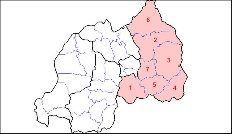
Map of Eastern Province, Rwanda
It has seven districts: Bugesera, Gatsibo, Kayonza, Ngoma, Kirehe, Nyagatare and Rwamagana. The capital city of the Eastern Province is Rwamagana.
The Eastern Province comprises the former provinces of Kibungo and Umutara, most of Kigali Rural, and part of Byumba.
History
It is not known when the territory of present day Rwanda was first inhabited, but it is thought that humans moved into the area following the last ice age either in the Neolithic period, around ten thousand years ago, or in the long humid period which followed, up to around 3000 BC. Archaeological excavations have revealed evidence of sparse settlement by hunter gatherers in the late stone age, followed by a larger population of early Iron Age settlers, who produced dimpled pottery and iron tools. By the 17th century it is thought that most of Rwanda was inhabited, with a fairly even spread of population across the hills of the country.