
Length 82 km Source Cedar Lake | Basin area 1,222 km² | |
 | ||
Similar Spartan Stadium, Beaumont Tower, W J Beal Botanical Garden, Michigan State University, Eli and Edythe Broad Art | ||
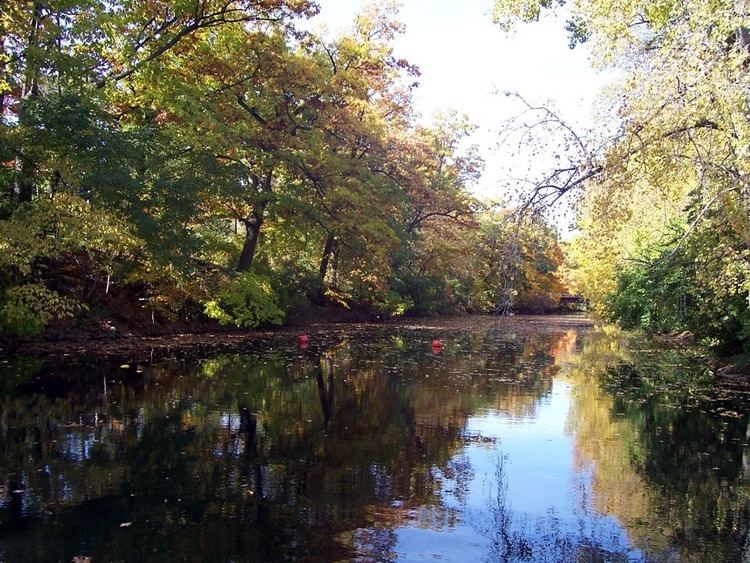
The Red Cedar River is a westward-flowing tributary of the Grand River in Michigan. Its source is Cedar Lake which is located in Marion Township in the southeastern corner of Livingston County, and it runs about 51.1 miles (82.2 km) through Okemos, East Lansing, including the campus of Michigan State University, and finally Lansing, where it empties into the Grand River. It has a West and a Middle branch, each of which also originates in southern Livingston County.
Contents
- Map of Red Cedar River Lansing MI USA
- Additional information
- Importance to Michigan State University
- References
Map of Red Cedar River, Lansing, MI, USA
Additional information
It is not navigable by boats any larger than recreational size, and is not an important shipping route. Its watershed area is estimated at 472 square miles (1,220 km2), and it has 12 tributaries of its own. Since the national Clean Water Act in 1972, the river has greatly improved and is safe for swimming 74% of the year (the exception usually being right after heavy rains which bring higher levels of E. coli from runoff waters). The Red Cedar is regularly monitored by MSU Water with the contaminant reports posted by the Michigan State University International Center. Despite these improvements, littering and pollution into the river and onto its banks is a common problem and includes bikes, parking barricades, general trash, and occasionally large items such as car tires and mopeds. To combat this problem, twice per year the undergraduate MSU Fisheries and Wildlife club holds a "Red Cedar Clean-Up" event that brings students, faculty, alumni, and community members together to remove and recycle items found in the river and its banks. The river is named for the trees commonly known as "red cedar" that were prevalent and still are somewhat common near the river's source and beginning length. The tree however, is properly a type of juniper, Juniperus virginiana.
Importance to Michigan State University
The Red Cedar River is a familiar campus landmark at Michigan State University. The name of the river is featured in the first line of MSU's fight song, and MSU students can be found studying in the parkland along its banks. People on campus frequently feed the large community of mallard ducks that congregate near the river. Wildlife in the river includes 33 species of fish and various other aquatic animals, and study of the river and its ecosystem is incorporated into relevant areas of the university's curricula. Fishing was banned on the campus in the 1960s; the ban was rescinded for a section of the river in 2013. The river is popular in the summer for canoeing and kayaking. (The campus canoe dock is self-mockingly named Red Cedar Yacht Club.) During floods, the river forms a standing wave at the campus dam that can be surfed. In the winter, the river often freezes over and students walk or play on the ice despite the inherent danger.