
 | ||
Earth radius is the distance from the Earth's center to its surface, about 6,371 km (3,959 mi). This length is also used as a unit of distance, especially in astronomy and geology, where it is usually denoted by R⊕.
Contents
- Introduction
- Physics of Earths deformation
- Radius and local conditions
- Fixed radius
- Equatorial radius
- Polar radius
- Geocentric radius
- Notable geocentric radii
- Principal sections
- Directional
- Combinations
- Global average radii
- Mean radius
- Authalic radius
- Volumetric radius
- Rectifying radius
- Osculating sphere
- References
This article deals primarily with spherical and ellipsoidal models of the Earth. See Figure of the Earth for a more complete discussion of the models. The Earth is only approximately spherical, so no single value serves as its natural radius. Distances from points on the surface to the center range from 6,353 km to 6,384 km (3,947–3,968 mi). Several different ways of modeling the Earth as a sphere each yield a mean radius of 6,371 km (3,959 mi).
While "radius" normally is a characteristic of perfect spheres, the term as used in this article more generally means the distance from some "center" of the Earth to a point on the surface or on an idealized surface that models the Earth. It can also mean some kind of average of such distances, or of the radius of a sphere whose curvature matches the curvature of the ellipsoidal model of the Earth at a given point.
An early report on the circumference of the Earth was given by Aristotle at 400,000 stadia, which exceeds the actual mean value by a factor of ten. The first scientific estimation of the radius of the Earth was given by Eratosthenes about 240 BC. Estimates of the accuracy of Eratosthenes’s measurement range from within 2% to within 15%. As with Aristotle's report, uncertainty in the accuracy of his measurement is due to modern uncertainty over which stadion definition he used.
Introduction
Earth's rotation, internal density variations, and external tidal forces cause its shape to deviate systematically from a perfect sphere. Local topography increases the variance, resulting in a surface of profound complexity. Our descriptions of the Earth's surface must be simpler than reality in order to be tractable. Hence, we create models to approximate characteristics of the Earth's surface, generally relying on the simplest model that suits the need.
Each of the models in common use involve some notion of the geometric radius. Strictly speaking, spheres are the only solids to have radii, but broader uses of the term "radius" are common in many fields, including those dealing with models of the Earth. Here is a partial list of models of the Earth's surface, ordered from exact to more approximate:
In the case of the geoid and ellipsoids, the fixed distance from any point on the model to the specified center is called "a radius of the Earth" or "the radius of the Earth at that point". It is also common to refer to any mean radius of a spherical model as "the radius of the earth". When considering the Earth's real surface, on the other hand, it is uncommon to refer to a "radius", since there is generally no practical need. Rather, elevation above or below sea level is useful.
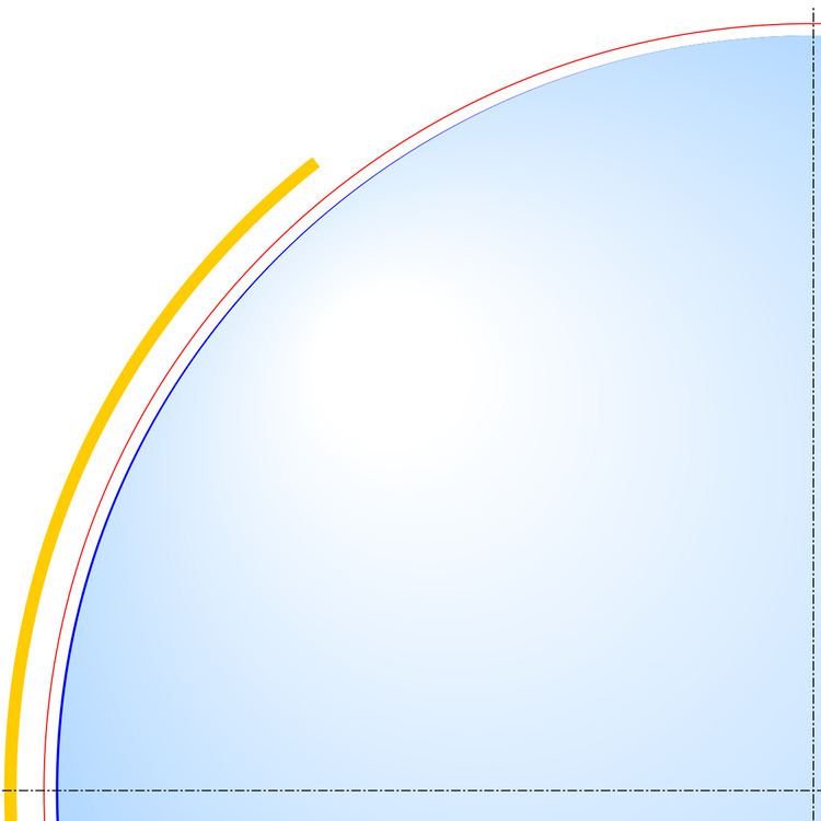
Regardless of the model, any radius falls between the polar minimum of about 6,357 km and the equatorial maximum of about 6,378 km (3,950 to 3,963 mi). Hence, the Earth deviates from a perfect sphere by only a third of a percent, which supports the sphere model in many contexts and justifies the term "radius of the Earth". While specific values differ, the concepts in this article generalize to any major planet.
Physics of Earth's deformation
Rotation of a planet causes it to approximate an oblate ellipsoid/spheroid with a bulge at the equator and flattening at the North and South Poles, so that the equatorial radius a is larger than the polar radius b by approximately aq. The oblateness constant q is given by
where ω is the angular frequency, G is the gravitational constant, and M is the mass of the planet. For the Earth 1/q ≈ 289, which is close to the measured inverse flattening 1/f ≈ 298.257. Additionally, the bulge at the equator shows slow variations. The bulge had been decreasing, but since 1998 the bulge has increased, possibly due to redistribution of ocean mass via currents.
The variation in density and crustal thickness causes gravity to vary across the surface and in time, so that the mean sea level differs from the ellipsoid. This difference is the geoid height, positive above or outside the ellipsoid, negative below or inside. The geoid height variation is under 110 m (360 ft) on Earth. The geoid height can change abruptly due to earthquakes (such as the Sumatra-Andaman earthquake) or reduction in ice masses (such as Greenland).
Not all deformations originate within the Earth. The gravity of the Moon and Sun cause the Earth's surface at a given point to undulate by tenths of meters over a nearly 12-hour period (see Earth tide).
Radius and local conditions
Given local and transient influences on surface height, the values defined below are based on a "general purpose" model, refined as globally precisely as possible within 5 m (16 ft) of reference ellipsoid height, and to within 100 m (330 ft) of mean sea level (neglecting geoid height).
Additionally, the radius can be estimated from the curvature of the Earth at a point. Like a torus, the curvature at a point will be greatest (tightest) in one direction (north–south on Earth) and smallest (flattest) perpendicularly (east–west). The corresponding radius of curvature depends on the location and direction of measurement from that point. A consequence is that a distance to the true horizon at the equator is slightly shorter in the north/south direction than in the east-west direction.
In summary, local variations in terrain prevent the definition of a single absolutely "precise" radius. One can only adopt an idealized model. Since the estimate by Eratosthenes, many models have been created. Historically, these models were based on regional topography, giving the best reference ellipsoid for the area under survey. As satellite remote sensing and especially the Global Positioning System gained importance, true global models were developed which, while not as accurate for regional work, best approximate the Earth as a whole.
Fixed radius
The following radii are fixed and do not include a variable location dependence. They are derived from the World Geodetic System 1984 (WGS-84) standard ellipsoid.
The value for the equatorial radius is defined to the nearest 0.1 m in WGS-84. The value for the polar radius in this section has been rounded to the nearest 0.1 m, which is expected to be adequate for most uses. Refer to the WGS-84 ellipsoid if a more precise value for its polar radius is needed.
The radii in this section are for an idealized surface. Even the idealized radii have an uncertainty of ±2 m. The discrepancy between the ellipsoid radius and the radius to a physical location may be significant. When identifying the position of an observable location, the use of more precise values for WGS-84 radii may not yield a corresponding improvement in accuracy.
The symbol given for the named radius is used in the formulae found in this article.
Equatorial radius
The Earth's equatorial radius a, or semi-major axis, is the distance from its center to the equator and equals 6,378.1370 km (3,963.1906 mi). The equatorial radius is often used to compare Earth with other planets.
Polar radius
The Earth's polar radius b, or semi-minor axis, is the distance from its center to the North and South Poles, and equals 6,356.7523 km (3,949.9028 mi).
Geocentric radius
The distance from the Earth's center to a point on the spheroid surface at geodetic latitude φ is:
where a and b are, respectively, the equatorial radius and the polar radius.
Notable geocentric radii
Principal sections
There are two principal radii of curvature: along the meridional and prime-vertical normal sections.
Meridional
In particular, the Earth's radius of curvature in the (north–south) meridian at φ is:
This is the radius that Eratosthenes measured.
Prime vertical
If one point had appeared due east of the other, one finds the approximate curvature in the east–west direction.
This radius of curvature in the prime vertical, which is perpendicular (normal or orthogonal) to M at geodetic latitude φ is:
Note that N = R at the equator:
The Earth's meridional radius of curvature at the equator equals the meridian's semi-latus rectum:
b2/a = 6,335.439 kmThe Earth's polar radius of curvature is:
a2/b = 6,399.594 kmDirectional
The Earth's radius of curvature along a course at an azimuth (measured clockwise from north) α at φ is derived from Euler's curvature formula as follows:
Combinations
It is possible to combine the principal radii of curvature above in a non-directional manner.
The Earth's Gaussian radius of curvature at latitude φ is:
The Earth's mean radius of curvature at latitude φ is:
Global average radii
The Earth can be modeled as a sphere in many ways. This section describes the common ways. The various radii derived here use the notation and dimensions noted above for the Earth as derived from the WGS-84 ellipsoid; namely,
a = Equatorial radius (6,378.1370 km)b = Polar radius (6,356.7523 km)A sphere being a gross approximation of the spheroid, which itself is an approximation of the geoid, units are given here in kilometers rather than the millimeter resolution appropriate for geodesy.
Mean radius
The International Union of Geodesy and Geophysics (IUGG) defines the mean radius (denoted R1) to be
For Earth, the mean radius is 6,371.0088 km (3,958.7613 mi).
Authalic radius
Earth's authalic ("equal area") radius is the radius of a hypothetical perfect sphere that has the same surface area as the reference ellipsoid. The IUGG denotes the authalic radius as R2.
A closed-form solution exists for a spheroid:
where e2 = a2 − b2/a2 and A is the surface area of the spheroid.
For the Earth, the authalic radius is 6,371.0072 km (3,958.7603 mi).
Volumetric radius
Another spherical model is defined by the volumetric radius, which is the radius of a sphere of volume equal to the ellipsoid. The IUGG denotes the volumetric radius as R3.
For Earth, the volumetric radius equals 6,371.0008 km (3,958.7564 mi).
Rectifying radius
Another mean radius is the rectifying radius, giving a sphere with circumference equal to the perimeter of the ellipse described by any polar cross section of the ellipsoid. This requires an elliptic integral to find, given the polar and equatorial radii:
The rectifying radius is equivalent to the meridional mean, which is defined as the average value of M:
For integration limits of [0,π/2], the integrals for rectifying radius and mean radius evaluate to the same result, which, for Earth, amounts to 6,367.4491 km (3,956.5494 mi).
The meridional mean is well approximated by the semicubic mean of the two axes:
yielding, again, 6,367.4491 km; or less accurately by the quadratic mean of the two axes:
about 6,367.454 km; or even just the mean of the two axes:
about 6,367.445 km (3,956.547 mi).
Osculating sphere
The best spherical approximation to the ellipsoid in the vicinity of a given point is given by the osculating sphere. Its radius equals the Gaussian radius of curvature as above, the center of the sphere is located at the center of curvature of the ellipsoid, and its radial direction coincides with the ellipsoid normal direction. This concept aids the interpretation of terrestrial and planetary radio occultation refraction measurements.