
Opening date 1978 Construction cost 960 million INR | Status Operational Length 1,207 m Construction began 1971 | |
 | ||
Official name Dharoi Water Resources Project Purpose Irrigation & water supply Similar Dantiwada Dam, Ukai Dam, Kadana Dam, Yeldari Dam, Kodasalli Dam | ||
Dharoi dam
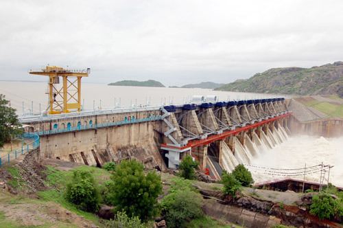
Dharoi Dam is a gravity dam on the Sabarmati river near Dharoi, Mehsana district of northern Gujarat in India. Constructed in 1978, the dam is meant for irrigation, power generation and flood control.
Contents
Map of Dharoi Dam, Dharoi, Gujarat 384360
About
19 villages partially and 28 villages fully submerged into its reservoir so they were relocated to new villages. Total land submerged under reservoir include 349.39 hectares (863.4 acres; 1.3490 sq mi) forest land, 2,727.55 hectares (6,739.9 acres; 10.5311 sq mi) wasteland, 7,489.87 hectares (18,507.9 acres; 28.9185 sq mi) cultivable land.
It irrigated 31,393 hectares (77,570 acres; 121.21 sq mi) in 2007-08.
References
Dharoi dam Wikipedia(Text) CC BY-SA