
Country Nepal Time zone NPT (UTC+5:45) Area 1,926 km² | Website www.ddcdhading.gov.np Zone Bagmati Zone | |
 | ||
Region Central Development Region, Nepal | ||
Dhading District (Nepali: धादिङ जिल्ला Listen , a part of Province No. 3, is one of the seventy-five districts of Nepal. The district, with Dhading Besi as its district headquarters, covers an area of 1,926 square kilometres (744 sq mi), had a population of 338,658 in 2001 and 336,067 in 2011.
Contents
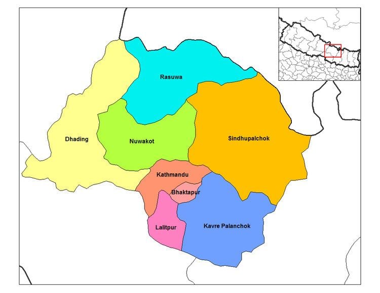
- Map of Dhading Nepal
- Rebuilding marpak vdc dhading district nepal
- Geography and climate
- Rivers
- Demography
- Religious temple
- References
Map of Dhading, Nepal
Rebuilding marpak vdc dhading district nepal
Geography and climate
The district spreads from 27'40" E to 28'17" E and 80'17"N to 84'35"N. The mountain range Ganesh Himal is the predominate mountain range located within Dhading. Some of the peaks are over 7,000 metres (23,000 ft). The 8,000-metre (26,000 ft) plus mountain Manaslu is clearly visible from much of Dhading, although it is located within the bounds of Gorkha. The transnational Prithivi Highway connecting Kathmandu and Pokhara runs through the southern portion of the district making for easy access to the Kathmandu valley. The road parallels the Trishuli River. The western border with Gorkha is bisected by the Budhigandaki River.
The district is bounded by
Dhading is the only district of Nepal which ranges from the mountain Ganesh Himal to the Churevawar pradesh of Terai (Chitwan). The district, with Dhading Besi as its district headquarters, covers an area of 1,926 square kilometres (744 sq mi) and has a population (2001) of 338,658. The mountain range "Ganesh" is the predominated mountain range located within Dhading. All of the peaks are over 7,000 metres (23,000 ft) with some approaching 8,000 metres (26,000 ft). The 8,000-metre (26,000 ft) plus mountain "Manaslu" is clearly visible from much of Dhading, although it is located within the bounds of Gorkha. The transnational "King Prithivi Highway" connecting Kathmandu and Pokhara runs through the southern portion of the district making for easy access too the Kathmandu valley. The road parallels the Trishuli River. Dhading is 80% farmland and 20% forest. The western border with Gorkha is bisected by the Budhigandaki River, one of the prettiest rivers of Nepal.
The people of the district are primarily Bhramin and Chetri in the south and Tamang and Gurung in the north, with much of the center Newari. Gurkha route, the birthplace of founder of Nepal King Prithivi Naryan Shah crosses through Dhading.
Rivers
The main river of the district is Ankhu Khola which comes from Ganesh Himal and passes through Khahare Tripureshwor and Salyantar and meets Budhi Gandaki at Narsingha Dhamm . Budhi Gandaki separates the district from Gorkha district. There are 25 small rivers, the main being Charoudi, Malekhu, Galtukhola, Belkhukhola, Chirandikhola, Maheshkhola, Thopal, Manukhola, Kastekhola, Mastekhola. Besides these, there are over 1743 smaller rivers, springs and seasonal streams.
Demography
The people of the district are primarily Brahmin and Chhetri in the south and Ghale, Gurung and Tamang in the north, with much of the center Newari. The famous King Prithivi Naryan Shah/Gurkha route crosses through Dhading.
Religious temple
Dhading District has many religious temples. Among them Tripurasundari Mai is one of the famous in Nepal as well, which lies in the northern part of the district. Similarly Siddha than in Salang VDC is a famous Hindu religious site. Others are Bhairabi Temple in Sunaula Bazar.