
OS grid reference TQ3384 Sovereign state United Kingdom Dialling code 020 | London borough HackneyIslington Postcode district N1 | |
 | ||
UK parliament constituency Hackney South and Shoreditch | ||
De Beauvoir Town (/də ˈbiːvər/ or /ˌdiː boʊˈvwɑːr/) is an area of north London in the London Borough of Hackney.
Contents
- 19th century
- 20th Century
- De Beauvoir Town in the arts
- Notable residents
- Elected representatives
- Transport and locale
- Walking and cycling
- References
De Beauvoir Town’s boundaries are Kingsland Road to the east, Regents Canal to the south, Southgate Road to the west and Ball’s Pond Road to the north; these last two boundaries are also part of the borough’s border with the London Borough of Islington.
Neighbouring districts include Islington, Barnsbury, Canonbury, Dalston and Shoreditch (Hoxton and Haggerston areas).
19th century
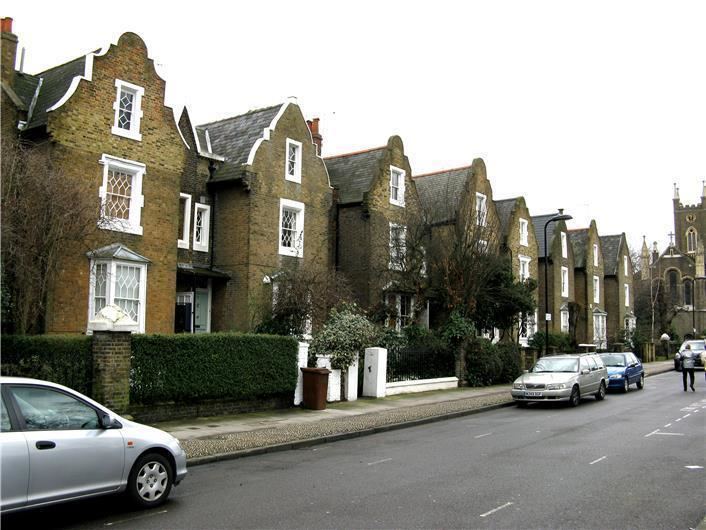
Until 1820 the area now covered by De Beauvoir Town was open country with a few grand houses. In 1821, stimulated by the opening of the Regent's Canal the previous year, developer and brick maker William Rhodes (1774-1843), a grandfather of Cecil Rhodes, secured a lease for 150 acres (0.61 km2) of land from Peter de Beauvoir. Rhodes planned to build residences for the upper classes in a grid pattern, with four squares on diagonal streets intersecting at an octagon. However, work stopped in 1823 when Rhodes was found to have obtained his lease unfairly and after a court case spanning over 20 years the land reverted to the de Beauvoir family in 1834.
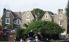
The delay in building had meant that Rhodes' clientele had since moved on to the new suburbs of the West End. The scheme was scaled down and of the planned squares only the southeastern was built, as De Beauvoir Square, although the diagonals partly survived in Enfield Road, Stamford Road and Ardleigh Road. Occupied in the 1840s by the newly emerging middle classes, the estate was almost wholly residential except around Kingsland Basin and the south-west corner where a factory was leased from 1823.
20th Century
In 1937, due to its easy access to Kingsland Basin, the southeast corner between Downham Road and Hertford Road was re-zoned for industrial use. Soon after all the area south of Downham Road was included. This distinguished it from the north side of Downham Road, which was already zoned for business and acted as a buffer for the mainly residential streets beyond. In 1938 De Beauvoir Crescent was suggested as another business zone to protect housing to the north.
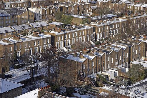
In the early 1960s the northern part of De Beauvoir Town between Buckingham Road and Tottenham Road was rebuilt as the Metropolitan Borough of Hackney's Kingsgate estate. In the late 1960s a larger area west of the canal basin, which contained many small factories, made way for the De Beauvoir Estate. The east side of De Beauvoir Square was also rebuilt as the Lockner Road estate.
In 1968 the De Beauvoir Town association was formed. The rest of the square with the area bounded by Englefield Road, Northchurch Road, Southgate Road, Hertford Road, and Stamford Road became a conservation area in 1969. This area was later extended to cover most of De Beauvoir Town; the eastern edge, however, is in the Kingsland conservation area.
De Beauvoir Town in the arts
The music video to accompany the release of "Stay With Me" by Sam Smith shows Sam coming out of a house and walking down a street in De Beauvoir Town. It was directed by Jamie Thraves.
Parts of the feature film 28 Weeks Later were filmed in De Beauvoir Town.
Notable residents
Edmund Gosse, the poet, the son of naturalist Philip Henry Gosse, lived in the area.
De Beauvoir Town was home to William Lyttle (1931–2010), a retired electrical engineer known as the Mole Man of Hackney, who dug a series of tunnels under his 20-room property on the corner of Mortimer Road and Stamford Road. In 2001, his tunnelling caused an 8 ft (2.4 m) hole to appear in the pavement on Stamford Road. Reports that the tunnelling had started again in 2006 were confirmed when Hackney Council found a network of tunnels and caverns, some 8 m (26 ft) deep, spreading up to 20m in every direction from his house.
In August 2006, the council obtained a court order banning Lyttle from his property. He died in 2010 and the fate of the house, by now derelict and needing a new roof, was thought to be uncertain. On 19 July 2012 the house was sold at auction for £1.12 million. As of summer 2013, the roofless property on its triangular site was supported by scaffolding and surrounded by a tall corrugated-iron fence.
Another notable resident was the architect Graham Parsey, who from the late 1960s with the formation of the DBA (De Beauvoir Association) worked to make the area a GIA (General Improvement Area) and therefore saved it from demolition initially and helped to protect its conserved status.
Elected representatives
The local MP is Meg Hillier. Local councillors for De Beauvoir ward are James Peters and Laura Bunt.
Transport and locale
The area is well served by buses.
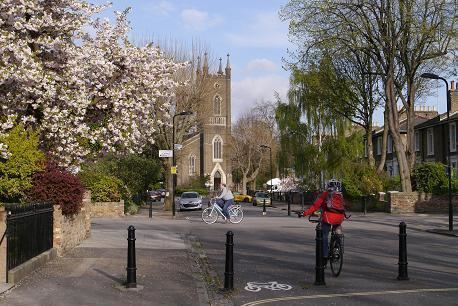
Walking and cycling
The Regents Canal towpath is easily accessible to pedestrians and cyclists. Travelling east, provides access to Victoria Park, and to the west, Islington.