
OS grid reference TQ345845 Sovereign state United Kingdom Dialling code 020 | London borough Hackney Postcode district E8,N1,N16 | |
 | ||
UK parliament constituency Hackney South and Shoreditch | ||
Ice cream milkshakes a k a freakshakes molly bakes dalston
Dalston (/ˈdɔːlstən/) is a district of the London Borough of Hackney in North East London, England. Dalston began as a hamlet within the parish of Hackney, which developed on either side of Dalston Lane. As the area urbanised, the term came to apply to surrounding areas including the old centres of Kingsland and Shacklewell, which are now considered part of Dalston.
Contents
- Ice cream milkshakes a k a freakshakes molly bakes dalston
- Map of Dalston London UK
- Walking through ridley road street market dalston london uk 18th november 2011
- Bounds
- History
- Notable buildings
- Festivals
- Entertainment
- Notable people
- Shopping
- Area profile
- Transport
- References
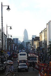
Map of Dalston, London, UK
The area’s best known former resident was Prime Minister Tony Blair who lived in Mapledene Road from 1980–86. Blair famously described Dalston as being on "the wrong side of Kingsland Road", contrasting the then deprived east London neighbourhood with the more fashionable north London districts on the other side of the road, which were favoured by his peers.
The same contrast could not be made today as gentrification has led to a rapid increase in the price of property, with current prices 8% above the London average. The process of change was accelerated by the East London line extension, now part of London Overground. The reopening of Dalston Junction Station on this extension was part of London's successful bid to hold the 2012 Olympics.
Walking through ridley road street market dalston london uk 18th november 2011
Bounds
Dalston has never been an administrative unit, and partly for this reason the boundaries are not fully defined. There are popularly understood boundaries in the south and west, but its northern and especially eastern extent is not delineated. This is a common situation in London’s neighbourhoods which often merge, overlap and change over time. There is an electoral Ward of the same name which covers a part of the north–west of Dalston.
Dalston’s boundaries are described with more or less precision below:
History
The name Dalston is thought to have derived from Deorlaf's tun (farm) in much the same way as nearby Hoxton was named after the farm of "Hoch". The first written record available is from 1294 when the name was written as Derleston.
The village was one of four small villages within the Parish of Hackney (along with Newington, Shacklewell, and Kingsland) that were grouped for assessment purposes, together having only as many houses as the village of Hackney.
John Rocque's map of 1746 shows the village of Kingsland centred on the crossroads at what is now Dalston Junction and the small village of Dalston further east along Dalston Lane. Another clear feature is Roman Ermine Street which now forms most of the western boundary of this area. Ermine Street now has the road number A10 and goes by a number of names, including Kingsland Road as it travels through London.
Around AD 1280 a leper hospital was founded in Dalston by the citizens of London and in AD 1549 it was attached to the chapel of St Bartholomew as an outhouse.
During the 18th and 19th centuries the area changed from an agricultural and rural landscape to urban one. By 1849, it was described as a recently increased suburban village, with some handsome old houses, and by 1859 the village had exceeded its neighbour and, with the railways and continuous building, the village of Kingsland disappeared.
Notable buildings
St. Mark’s is a large Victorian church primarily built in the period 1864-66 to a design by Chester Cheston. It is reputedly the largest parish church in London and its great size has earned it the nickname the “Cathedral of the East End”. The residential area around the church is also of high architectural quality and has accordingly been designated the “St. Mark’s Conservation Area”.
FiftySevenEast is a fifteen floor mixed use development under construction on the site of the former Peacock’s store on Kingsland High Street. The relatively tall nature of the scheme attracted a degree of controversy.
Festivals
Dalston is known for music, events and its nightlife. Its biggest festival to date began in 2015, Dalston Music Festival. Centred on Gillett Square and 8 clubs in the surrounding area, it was founded by Andrew Bunsell of Dalston Studios.
Entertainment
Dalston has always been an important transport and shopping centre. It was also, at one time, an important entertainment centre, with four or five cinemas within a radius of a ⅓ of a mile, and the Dalston Theatre, a former hippodrome and music hall that later became the Four Aces blues club and the Labyrinth nightclub. The Dalston Theatre was demolished in February 2007, despite an active local campaign to save it.
Dalston was a hub for 1970s and 1980s pub rock venues but these are largely defunct. However, the new Dalston Culture House, the first wing of which has opened on Gillett Square, hosts the Vortex Jazz Club, moved from Stoke Newington in 2005.
Notable people
Shopping
Established in the 1880s, Ridley Road Market is opposite Dalston Kingsland railway station. Fruit and vegetables, some fairly exotic, are available. Halal butchers cluster around the high street end of the market.
Ridley Road market is reputedly the basis for the one found in the BBC's EastEnders. The Kingsland Shopping Centre (formerly Dalston Cross) is just south of Ridley Road Market. Kingsland Road and the surrounding streets are home to an ever-growing number of boutiques, bars and cafés.
Area profile
Contemporary Dalston is a lively neighbourhood with an ethnically varied population. Architecturally it is a mixture of 18th and 19th century terraced houses and 20th century council estates. It is currently undergoing rapid gentrification, partly because of the redevelopment of the railway station at Dalston Junction and partly due to the revitalisation of large parts of east London in the build-up to the 2012 Olympics. (Hackney was one of the four host boroughs of the Games.)
Dalston has attracted immigrants for over 100 years; at the turn of the century it was a popular area for newly arrived Jewish people from central Europe. In the 1950s and '60s, as the Jewish community became more affluent and moved out, they were replaced by a large Caribbean community, which accounts for the wide choice of Caribbean food available in Ridley Road. As the Caribbean community slowly drifted out of Dalston it then became popular with the Turkish, as well as the Vietnamese. Recent arrivals include Poles, judging by the numbers of Polish delicatessens now appearing and other stores catering to Polish tastes.
Fassett Square was the inspiration for the BBC soap EastEnders. Originally, there were plans to film the series there, on location. However, Fassett Square (Albert Square) and Ridley Road Market (Walford Market) were rebuilt on the set in Elstree, near Borehamwood, to have a more controlled filming environment. The idea of Walford stems from Walford Road, and many of the houses on the show use the same exterior design. Coincidentally both Barbara Windsor and Tony Holland, one of the original creators of the show, lived at different times on the street.
The Hackney Peace Carnival Mural created in 1985, depicts a group of people marching for peace against "the bomb" and has become an important cultural statement from that era. It can be found opposite Dalston Junction Overground station on Dalston Lane. It has also been used on the cover of an album by local group Rudimental.
That is not the only connection with entertainment industry. Around the corner, music hall artist Marie Lloyd (1870–1922) used to reside on Graham Road. The house now has a blue plaque.
In April 2009 the Guardian published an article on Dalston claiming that it was the "coolest" place to live in Britain. In the same year however, sculpture park The Towers of Hackney was torn down to give way to new buildings.
Transport
Dalston has two stations, Dalston Kingsland and Dalston Junction, both served by London Overground and linking with west and south London. Dalston has no direct rail link to central London; passengers often change at Highbury & Islington station for the London Underground.
A new station in Dalston is proposed for the Crossrail 2 line.
From 4 June 2011, bus route 488 was extended to Dalston from its previous terminus at Clapton.
Bus routes serving Dalston in daytime are 30, 38, 56, 67, 76, 149, 236, 242, 243, 277 and 488, and at nights 149, 242, 243, 277, N38 and N76.
Dalston Bus Garage on Shrubland Road has been demolished.