
Type Highway | Length 407 km | |
 | ||
Formerroute number National Route 55 (Springsure - Rolleston) | ||
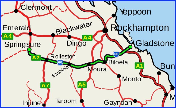
The Dawson Highway is a state highway in Queensland, Australia. It runs for 405 km between Gladstone and Springsure where it terminates. From Gladstone to Rolleston it is signed as State Route 60, and then A7 onwards to Springsure. It continues west for another 247 km as Dawson Developmental Road to Tambo on the Landsborough Highway. North of Springsure, A7 becomes the Gregory Highway.
Contents
Map of Dawson Hwy, Queensland, Australia
Many of the towns along the Dawson Highway are coal-mining establishments.
List of towns along the Dawson Highway
References
Dawson Highway Wikipedia(Text) CC BY-SA