
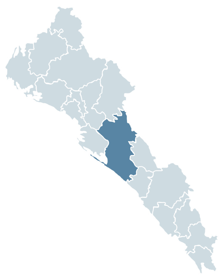
Country Area 65 km2 Mayor Sergio Torres Felix PRI | ||
 | ||
Colleges and Universities Autonomous University of Sinaloa, Universidad Casa Blanca, Mexico International University, Universidad Tecnologica de Sinaloa, TecMilenio University - Culiacan | ||
Bulletproof burial ground the narco tombs of culiacan sinaloa
Culiacán ( kuljaˈkan ) is a city in northwestern Mexico. It is the largest city in and the capital of the state of Sinaloa. It is also the seat of Culiacán Municipality. There are 675,773 inhabitants in the city (census of 2010) and 858,638 in the municipality. While the municipality has a total area of 4,758 km2 (1,837 sq mi), the city itself is dense, at only 65 km2 (25 sq mi).
Contents
- Bulletproof burial ground the narco tombs of culiacan sinaloa
- Map of Culiacn
- Hotel city express culiacan en culiacan
- Precolonial period
- Foundation
- After World War II
- Climate
- Economy
- Demographics
- Administrative divisions
- Media
- Universities
- Urban transport
- Rail
- Bus station
- Roads and expressways
- Main roads
- Bridges and tunnels
- Highways and freeways
- Airport
- Tourism
- Attractions
- Sports
- Entertainment
- Modeling
- Arts
- References
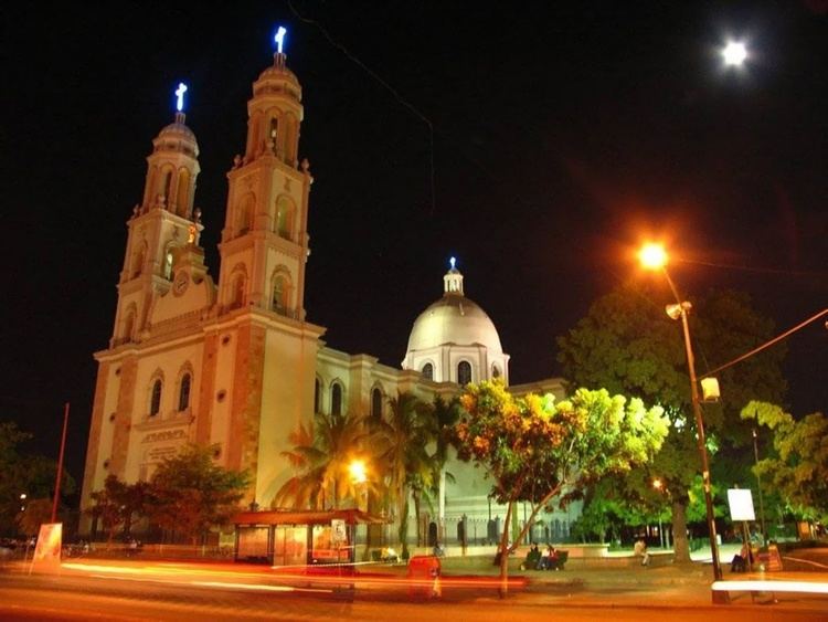
Map of Culiacán
The city is located in a valley at the confluence of the Tamazula and Humaya Rivers, where the two meet to form the Culiacán River, 55 m above sea level. It is in the center of the state, at about the same distance to the other urban centers of the state: Los Mochis to the north, Mazatlán to the south, and Altata at the west.
Hotel city express culiacan en culiacan
Precolonial period
The most accepted translation would be Colhuacan "place of those who adore the crooked god Coltzin". Other translation may be that come from the word coahuacan, which can mean "palace of snakes". Before the Spaniards arrived from Europe, this site had been a small Indian settlement since 628 when Amerindians had first founded it.
Foundation
The city existing today was founded in 1531 by the Spanish captain Nuño Beltrán de Guzmán and named San Miguel de Culiacán. In the same decade, it was the terminus of the long journey of Alvar Núñez Cabeza de Vaca and company among natives. Explorer Francisco Vásquez de Coronado set out from Culiacán to explore what is now the southwestern United States. Settlers from Europe came to Culiacán, and in the following centuries, Culiacán continued to be a quiet town. Only after the federal government built dams in the adjacent areas in the 1950s did agriculture explode and the city began to grow exponentially. Some of Mexico's largest agricultural conglomerates operate in the vast and fertile coastal plains. The agroindustrial economy continues to be the single largest contributor to the region's legal economy. While the vast majority of technical and skilled labor is educated locally, the once-seasonal field labor pool now experiences a yearly shortage of workers. International patterns of migration now draw laborers from deep within Mexico's south to the northern border states and into the United States.
After World War II
Beginning in the late 1950s, Culiacán became the birthplace of an incipient underground economy based on illicit drugs exported to the United States. The completion of the Pan-American Highway and the regional airport in the 1960s accelerated the expansion of a workable distribution infrastructure for the enterprising few families that would later come to dominate the international drug cartels along Mexico's Pacific Northwest.
Climate
Culiacán has a semiarid climate (Köppen: BSh), despite receiving an annual rainfall over 600 mm (24 in), due to its hot temperatures and high evaporation. Summers are very hot and humid, shade temperatures can reach 45 °C (113 °F) and high humidity can produce heat indices of 50 to 55 °C (122 to 131 °F), with the risk of heavy rainfall from decaying tropical cyclones also present. Winters are much milder with less humidity and an average high of 27 °C, with cool nights.
Economy
Culiacán's economy is mainly agricultural and commerce, being a trade center for produce, meat, and fish. Among other industries, Culiacán represents 32% of the state economy.
Some companies of national importance are headquartered in Culiacan, such as Coppel, Casa Ley, Homex, and others.
The Sinaloa Cartel, a drug-trafficking and organized crime syndicate, is based in Culiacán.
Demographics
The total population of the city is 675,773. Immigration to Culiacán comes from all parts of the world, but especially from southern Mexico, Japan, China, and Europe (Italy, France, Spain, Germany, Greece).
Administrative divisions
Culiacán is divided into 27 sectors (sectores), which are groups of several quarters (colonias):
Media
The newspaper El Debate is published in Culiacán.
Universities
Urban transport
At present, Culiacán has just over 68 urban transport routes, which serve about 1 million users. The Culiacán urban transport is operated by RedPlus.
Rail
The city has a train station, operated by Ferromex, and it is used only to transport freight. It is connected to south with Mazatlán and north with Guaymas.
Bus station
Culiacán uses the Central Internacional de Autobuses "Millennium" ("Millennium" International Buses Station) to travel across all Mexico (north, central, and south) and to the United States (Arizona and California). This replaced the old bus terminal in the southern city.
Roads and expressways
Though several high-speed roads have been built, most of the city's streets are rather narrow and traffic jams are common at rush hours. Now, 300,000 cars are in Culiacan, making the per capita number of cars one of the highest in the country considering the 745,000 inhabitants.
Main roads
Culiacán has several roads (avenues, boulevards, streets, etc.), but some of these are the main quick connection to other points of the city.
Bridges and tunnels
The city has a total of 13 bridges: six across the Tamazula River, two spanning the Humaya River, and the longest one with other four crossing the Culiacán River. Efforts to solve traffic problems have been made, but most of the city streets and bridges are now crowded and insufficient to handle regular and rush hours traffic; a 40-km/h speed limit in most parts of the city worsens the situation.
Also, Culiacán has bridges in streets conforming to high transit systems in places where the rush hour is common.
On Feb. 17, 2014, investigators from Mexico and the United States learned Joaquín Guzmán Loera, or El Chapo, was using underground sewage tunnels in Culiacán by constructing hatches connecting to the drainage network in the bathtubs of his city "stash houses". On at least one occasion, authorities chased Guzman into the tunnels, but lost him. An AP reporter said some of the tunnels were well lit, had wood paneling, and were air conditioned.
Highways and freeways
Culiacán is a rail junction and is located on the Panamerican Highway that runs north to the United States and south to Guadalajara and Mexico City, and the Benito Juárez Highway or Maxipista, which is a toll road that runs parallel to the toll-free federal highway. It is connected to the north with Los Mochis and to the south with Mazatlán, Tepic, and Guadalajara with the Federal Highway 15.
Culiacán is linked to the satellite city of Navolato by an excellent freeway that now reaches Altata, in the Pacific Ocean coast. Culiacán is also linked to Tamazula de Victoria in Durango state.
Airport
Culiacán is served by Federal de Bachigualato International Airport (IATA: CUL, ICAO: MMCL), the most important domestic gateway in the state of Sinaloa, and the second in international operations after Mazatlán International Airport. It is located south of downtown; it is also the 10th Mexican Air Force base.
Tourism
Attractions
Sports
The city is home to three professional league sport teams: baseball with the Tomateros de Culiacán from the Liga Mexicana del Pacífico, two championships in Caribbean series in 1996 and 2002; and soccer with Dorados de Sinaloa, who play at the Estadio Banorte (Estadio Carlos González) and basketball with the Caballeros de Culiacan from the CIBACOPA. Duck, dove, and goose hunting season goes from early November through March. Culiacán also holds a yearly international marathon.