
Population 5,589 (2016) | Elevation 1,310 m | |
 | ||
Weather -9°C, Wind SE at 14 km/h, 93% Humidity Points of interest Frank Slide Interpretive Centre, Crowsnest Lake, Pass Powderkeg, Turtle Mountain, Leitch Collieries Provincial | ||
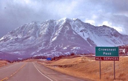
Hwy 3 crowsnest pass and the frank slide alberta
Crowsnest Pass (sometimes referred to as Crow's Nest Pass, French: passe du Nid-de-Corbeau) is a low mountain pass across the Continental Divide of the Canadian Rockies on the Alberta–British Columbia border.
Contents
- Hwy 3 crowsnest pass and the frank slide alberta
- Map of Crowsnest Pass AB Canada
- Geography
- Transportation
- History
- References
Map of Crowsnest Pass, AB, Canada
Geography
The pass is located in southeast British Columbia and southwest Alberta, and is the southernmost rail and highway route through the Canadian Rockies. It is the lowest-elevation mountain pass in Canada south of the Yellowhead Pass (1,130 m (3,710 ft)); the other major passes, which are higher, being Kicking Horse Pass (1,640 m (5,380 ft)), Howse Pass (1,530 m (5,020 ft)) and Vermilion Pass (1,680 m (5,510 ft)).
Crowsnest Pass comprises a valley running east–west through Crowsnest Ridge. On the Alberta side, the Crowsnest River flows east from Crowsnest Lake, eventually draining into the Oldman River and ultimately reaching Hudson Bay via the Nelson River. Summit Lake on the British Columbia side drains via three intermediary creeks into the Elk River, which feeds into the Kootenay River, and finally into the Columbia River to the Pacific.
Transportation
In prehistoric times, aboriginals used this major breach through the Front Ranges for seasonal migrations, and also for trade between mountain and plains cultures. The first motor vehicle to cross the Canadian Rockies did so via Phillipps Pass, about 1 km north of Crowsnest Pass, and in 1917 a road was blasted around the shores of Crowsnest Lake and across Crowsnest Pass, renamed Interprovincial Highway Three in 1932. It is also known as the Crowsnest Highway.
The Canadian Pacific Railway built the Crowsnest Route line from Lethbridge, Alberta, to Kootenay Landing, British Columbia, through the Crowsnest Pass between 1897 and 1898. This line was built primarily to access mineral-rich southeastern BC via an all-Canadian rail route, and to assert Canadian (and CPR) sovereignty in an area that U.S. railroads were beginning to build into. It also opened up coal deposits in the Crowsnest and Elk River valleys which were important to mineral smelting operations and assisted the CPR in its conversion of locomotives from wood to coal. The CPR sought and received construction funding from the federal government, partially in exchange for a freight subsidy on prairie farm exports and equipment imports which came to be called the "Crow's Nest Pass Agreement".
"The Crow Rate", as the subsidy agreement came to be referred to, was eventually extended from CPR's Crowsnest Pass railway line to apply to all railway lines in western Canada, regardless of corporate ownership or geography, creating artificially low freight rates for grain shipments through the Great Lakes ports. The rate also correspondingly limited industrial growth in the western provinces as it was cheaper to produce items in eastern Canada and ship them west under the Crow Rate. This subsidy was finally abolished in 1995.
On August 7, 1919, Capt. Ernest Hoy flew a Curtiss JN4 "Jenny" through Crowsnest Pass, the first flight across the Canadian Rockies.