
Country Canada - Town January 1, 1979 Elevation 1,310 m | Province Alberta Census division 15 - Specialized municipality January 16, 2008 Population 5,589 (2016) | |
 | ||
Weather -9°C, Wind SE at 14 km/h, 93% Humidity Points of interest Frank Slide Interpretive Centre, Crowsnest Lake, Pass Powderkeg, Turtle Mountain, Leitch Collieries Provincial | ||
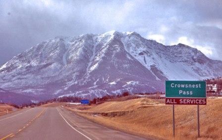
Crowsnest pass alberta canada
The Municipality of Crowsnest Pass is a specialized municipality located in the Crowsnest Pass of the Rocky Mountains in southwest Alberta, Canada. The municipality formed as a result of the amalgamation of five municipalities – the Village of Bellevue, the Town of Blairmore, Town of Coleman, the Village of Frank and Improvement District No. 5 (which included the Hamlet of Hillcrest) – on January 1, 1979. Today, Blairmore and Coleman remain the two largest communities while Frank is the smallest. Crowsnest, Passburg, and Sentinel (Sentry Siding) are other former communities (abandoned, or much reduced) within the municipality's boundaries.
Contents
- Crowsnest pass alberta canada
- Map of Crowsnest Pass AB Canada
- History
- Communities and localities
- Demographics
- Attractions
- Trivia
- References
Map of Crowsnest Pass, AB, Canada
History
The municipality owes its existence to coal mining, the area's primary industry since the first mine opened in 1900. Its ethnic and cultural diversity comes from the many European and other immigrants attracted to the area by the mines. Through the years coal mining suffered from fluctuating coal prices, bitter strikes, and underground accidents, and all the mines on the Alberta side closed throughout the 20th century as cheaper, safer open-pit mines opened on the British Columbia side of the pass. There is an operating coal mine just across the B.C. border in Sparwood which continues to provide significant employment for the Municipality of Crowsnest Pass.
Crowsnest Pass is known for tragedy. In 1903 the tip of Turtle Mountain broke loose and decimated part of the Village of Frank (the Frank Slide). In 1914, the Hillcrest mine disaster occurred in the Hillcrest Mine, killing 189 men. Serious spring floods occurred in 1923 and 1942. Periodic forest fires have swept the valley, including one in the summer of 2003 that threatened the entire municipality.
The area was a centre for "rum-running" during the prohibition of 1916 - 1923, when liquor was illegally brought across the provincial border from British Columbia. This legacy is celebrated each July during Rum-Runner Days, which includes a parade, many civic and sporting events, and a fireworks display called Thunder In the Valley that attracts tens of thousands of visitors from nearby communities. In 2012 Thunder in the Valley fireworks display was removed from "rum runner days"
In 2012 some residents became concerned with the quality of the representation the local government was providing. A petition was organized within the framework of the Alberta Municipal Government Act requesting the Minister of Municipal Affairs to investigate the quality of government being provided by the Mayor Bruce Decoux and Council. In turn the Minister of Municipal Affairs responded by sanctioning a municipal inspection and hired Russell Farmer & Associates Consulting Ltd. to conduct in 2013 an inspection of the management, administration, and operations of the Municipality of Crowsnest Pass.
Communities and localities
The following communities are the former municipalities that comprise the Municipality of Crowsnest Pass:
The following localities are located within the Municipality of Crowsnest Pass:
Demographics
In the 2016 Census of Population conducted by Statistics Canada, the Municipality of Crowsnest Pass recorded a population of 5,589 living in 2,567 of its 3,225 total private dwellings, a change of 6999400000000000000♠0.4% from its 2011 population of 5,565. With a land area of 371.44 km2 (143.41 sq mi), it had a population density of 15.0/km2 (39.0/sq mi) in 2016.
In the 2011 Census, the Municipality of Crowsnest Pass had a population of 5,565 living in 2,586 of its 3,234 total dwellings, a change of -3.2% from its 2006 population of 5,749. With a land area of 373.07 km2 (144.04 sq mi), it had a population density of 14.9/km2 (38.6/sq mi) in 2011.
Attractions
Within the Municipality of Crowsnest Pass one can find the Frank Slide Interpretive Centre, an interpretive display at Leitch Collieries Provincial Historic Site, underground tours of the Bellevue Mine Provincial Historic Site, and the Crowsnest Museum in downtown Coleman where pamphlets for self-guided historical driving tours of the municipality are also available. The area offers hiking and fishing in the summer, and in winter snowmobiling, a downhill ski hill, and a groomed cross-country ski area, and is about 70 kilometres (43 mi) from major ski hills at both Fernie Alpine Resort and Castle Mountain Resort.