Supriya Ghosh (Editor)

Crow River (Minnesota)

Updated on
Edit
Like
Comment
Share on FacebookTweet on TwitterShare on LinkedInShare on Reddit
Length
  
40 km

Mouth
  
Mississippi River

Bridges
  
Hanover Bridge

Basin area
  
7,138 km²

Country
  
United States of America

Crow River (Minnesota) httpsuploadwikimediaorgwikipediaenthumb1

Sources
  
North Fork Crow River, South Fork Crow River

Cities
  
St. Michael, Hanover, Dayton, Otsego, Greenfield

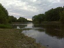
The Crow River is a tributary of the Mississippi River in south-central Minnesota in the United States. It drains a watershed of 2,756 square miles (7,140 km2).

Contents

Map of Crow River, Minnesota, USA

NameEdit

The earliest record of the name for Crow River is "Karishon River", reflecting the Dakota language Khaŋǧí Šúŋ Watpá (now Wakpá), meaning "The Large Wing-feather of the Crow River". In other documents, this was translated as "Crow Wing River", or by it's Ojibwe language name "Undeg-sipi" (from Aandego-ziibi), meaning "Crow River". Early explorers recorded the name of this river in various ways: "Goose River" by Jonathan Carver, "Rook's River" by Giacomo Beltrami, and as "Karishon or Crow River" by Joseph Nicollet. The North Fork of the Crow River was named by the Ojibwe Indians for the bird they called the "marauder of newly planted corn."

HydrographyEdit

The Crow River flows for most of its length as three streams:

  • The North Fork Crow River, 157.5 miles (253.4 km) long, flows from Grove Lake in eastern Pope County and follows a generally east-southeastward course through southwestern Stearns, northeastern Kandiyohi, northern Meeker and central Wright counties, through Rice Lake and Lake Koronis and past the towns of Regal, Paynesville and Kingston. A minor headwaters tributary of the North Fork is named the Skunk River.
  • The Middle Fork Crow River, 45.1 miles (72.6 km) long, rises near Belgrade in southwestern Stearns County and flows into Kandiyohi County, initially southward through Mud Lake and Nest Lake and past the town of New London, then eastward through Green Lake and Calhoun Lake and into northern Meeker County, where it joins the North Fork.
  • The South Fork Crow River, 116.0 miles (186.7 km) long, flows from Wagonga and Little Kandiyohi lakes in south-central Kandiyohi County and follows a generally eastward course through southwestern Meeker, northern McLeod, northwestern Carver and southeastern Wright counties, past the towns of Cosmos, Hutchinson, Lester Prairie, Mayer, Watertown and Delano. Portions of the South Fork's upper course have been heavily straightened and channelized.
  • The north and south forks converge at Rockford to form the Crow River, which flows for 24.8 miles (39.9 km) northeastward to the Mississippi River. The river's course is used to define the boundary between Wright and Hennepin counties.

    The Crow flows throughGreenfield, Hanover, St. Michael, Otsego and Dayton; it enters the Mississippi River from the south at the common boundary between Otsego and Dayton.

    References

    Crow River (Minnesota) Wikipedia