
Country United States FIPS code 27-49966 Area 6.01 km² Zip code 56362 Local time Saturday 2:26 AM | Time zone Central (CST) (UTC-6) GNIS feature ID 0649194 Elevation 357 m Population 2,422 (2013) Area code 320 | |
 | ||
Weather 2°C, Wind E at 13 km/h, 85% Humidity | ||
Meet bill wuertz a chicken farmer from paynesville minnesota
Paynesville is a city in Stearns County, Minnesota, United States, on Lake Koronis, in the central part of the state. The population was 2,432 at the 2010 census. It is part of the St. Cloud Metropolitan Statistical Area.
Contents
- Meet bill wuertz a chicken farmer from paynesville minnesota
- Map of Paynesville MN 56362 USA
- How to say or pronounce usa cities paynesville minnesota
- History
- Geography
- 2010 census
- 2000 census
- Transportation
- Lake Koronis
- Rice Lake
- References
Map of Paynesville, MN 56362, USA
How to say or pronounce usa cities paynesville minnesota
History
Paynesville was platted in 1857 by Edwin E. Payne, and named for him. A post office has been in operation at Paynesville since 1857.
Geography
Paynesville is located along the North Fork of the Crow River and Lake Koronis. According to the United States Census Bureau, the city has a total area of 2.32 square miles (6.01 km2), all of it land.
2010 census
As of the census of 2010, there were 2,432 people, 1,065 households, and 635 families residing in the city. The population density was 1,048.3 inhabitants per square mile (404.8/km2). There were 1,148 housing units at an average density of 494.8 per square mile (191.0/km2). The racial makeup of the city was 97.0% White, 0.5% African American, 0.1% Native American, 0.4% Asian, 0.9% from other races, and 1.1% from two or more races. Hispanic or Latino of any race were 2.2% of the population.
There were 1,065 households of which 26.9% had children under the age of 18 living with them, 46.9% were married couples living together, 7.1% had a female householder with no husband present, 5.6% had a male householder with no wife present, and 40.4% were non-families. 35.8% of all households were made up of individuals and 20.4% had someone living alone who was 65 years of age or older. The average household size was 2.20 and the average family size was 2.83.
The median age in the city was 42.4 years. 22.1% of residents were under the age of 18; 6.9% were between the ages of 18 and 24; 23.6% were from 25 to 44; 21.9% were from 45 to 64; and 25.3% were 65 years of age or older. The gender makeup of the city was 47.7% male and 52.3% female.
2000 census
As of the census of 2000, there were 2,267 people, 934 households, and 594 families residing in the city. The population density was 1,715.2 people per square mile (663.1/km²). There were 984 housing units at an average density of 744.5 per square mile (287.8/km²). The racial makeup of the city was 98.81% White, 0.04% African American, 0.09% Native American, 0.31% Asian, 0.22% from other races, and 0.53% from two or more races. Hispanic or Latino of any race were 1.28% of the population.
There were 934 households out of which 28.2% had children under the age of 18 living with them, 54.1% were married couples living together, 6.7% had a female householder with no husband present, and 36.4% were non-families. 32.9% of all households were made up of individuals and 20.0% had someone living alone who was 65 years of age or older. The average household size was 2.32 and the average family size was 2.95.
In the city, the population was spread out with 23.0% under the age of 18, 8.8% from 18 to 24, 24.2% from 25 to 44, 18.9% from 45 to 64, and 25.1% who were 65 years of age or older. The median age was 40 years. For every 100 females there were 88.3 males. For every 100 females age 18 and over, there were 82.0 males.
The median income for a household in the city was $34,000, and the median income for a family was $42,500. Males had a median income of $30,978 versus $20,219 for females. The per capita income for the city was $17,246. About 4.5% of families and 8.1% of the population were below the poverty line, including 4.6% of those under age 18 and 15.2% of those age 65 or over.
Transportation
Minnesota State Highways 4, 23, and 55 are three of the main routes in the city.
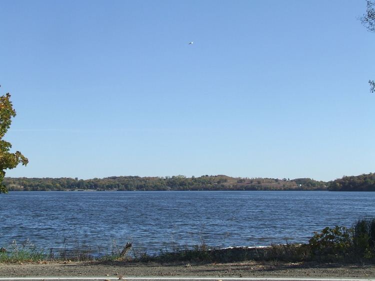
Lake Koronis
area: 3014 acres MN DNR
Located only one mile south of Paynesville, Lake Koronis offers some of the best fishing in the area, with an abundance of walleye, bass, northern pike, making it one of the premier lakes in central Minnesota.
Rice Lake
area: 1639 acres MN DNR
Located about five miles east-southeast of Paynesville, Rice Lake also offers excellent walleye, bass, and northern pike fishing. Public lake access exists on the northwest shore at the end of 180th Street, and on the southwest shore, at the end of 253rd Avenue.