
Area 7,270 km² Population 3,807 (2013) Unemployment rate 5.8% (Apr 2015) | Website www.co.crockett.tx.us Founded 1875 | |
 | ||
Rivers Pecos River, Indian Water Hole Spring, Live Oak Creek | ||
Crockett County is a county located on the Edwards Plateau in the U.S. state of Texas. As of the 2010 census, its population was 3,719. The county seat is Ozona. The county was founded in 1875 and later organized in 1891. It is named in honor of Davy Crockett, the legendary frontiersman who died at the Battle of the Alamo.
Contents
- Map of Crockett County TX USA
- History
- Geography
- Major highways
- Adjacent counties
- Demographics
- Census designated place
- Ghost Town
- References
Map of Crockett County, TX, USA
History
Geography
According to the U.S. Census Bureau, the county has a total area of 2,807 square miles (7,270 km2), virtually all of which is land.
Major highways
Adjacent counties
Crockett County is among the few counties in the United States to border as many as nine counties.
Demographics
As of the census of 2000, there were 4,099 people, 1,524 households, and 1,114 families residing in the county. The population density was 1.46 people per square mile (0.56/km²). There were 2,049 housing units at an average density of 0.73 per square mile (0.28/km²). The racial makeup of the county was 76.34% White, 0.68% Black or African American, 0.59% Native American, 0.27% Asian, 0.02% Pacific Islander, 19.71% from other races, and 2.39% from two or more races. 54.70% of the population were Hispanic or Latino of any race.
There were 1,524 households out of which 36.50% had children under the age of 18 living with them, 60.30% were married couples living together, 9.30% had a female householder with no husband present, and 26.90% were non-families. 24.70% of all households were made up of individuals and 11.80% had someone living alone who was 65 years of age or older. The average household size was 2.65 and the average family size was 3.19.
In the county, the population was spread out with 28.90% under the age of 18, 7.10% from 18 to 24, 26.40% from 25 to 44, 24.70% from 45 to 64, and 12.90% who were 65 years of age or older. The median age was 37 years. For every 100 females there were 98.20 males. For every 100 females age 18 and over, there were 97.60 males.
The median income for a household in the county was $29,355, and the median income for a family was $34,653. Males had a median income of $29,925 versus $14,695 for females. The per capita income for the county was $14,414. About 14.90% of families and 19.40% of the population were below the poverty line, including 24.30% of those under age 18 and 18.20% of those age 65 or over.
Census-designated place
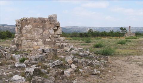
Ghost Town
There are no incorporated municipalities in Crockett County.