
Existed: by 1931 – present Length 326.9 km | ||
 | ||
North end: BL I-20 at Colorado City | ||
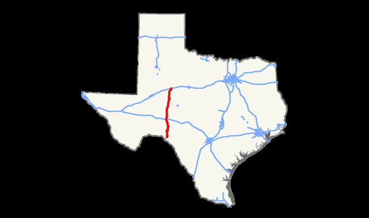
State Highway 163 or SH 163 is a 203-mile-long (327 km) state highway in the western part of Texas, United States.
Contents
Map of TX-163, Texas, USA
Route description
SH 163 runs almost directly north from its originating junction with U.S. Highway 90 at Comstock near the Rio Grande, the southern border of the state. The road passes east of the Seminole Canyon State Historical Park and along the Devils River to the ghost town of Juno. The highway continues north to Ozona at Interstate 10 and to Barnhart, where it junctions with U.S. Highway 67, and on to Sterling City. The highway is co-routed with U.S. Highway 87 at Sterling City, but then diverges after a few miles to continue northward to Colorado City and a final junction with Interstate 20 Business Loop (former U.S. Highway 80).
Counties traversed by the highway include Val Verde, Crockett, Irion, Tom Green, Sterling, and Mitchell. Most of the terrain covered by the highway is sparsely populated ranch country.
History
The original formation of the highway by 1931 included only the section from Comstock to Barnhart. In 1957 State Highway 101 and Ranch to Market Road 379 were cancelled and combined into the additional sections of SH 163 from Barnhart to Colorado City.