
Time zone BRT/BRST (UTC-3/-2) | Elevation 802 m (2,631 ft) | |
 | ||
Microregion Pires do Rio Microregion | ||
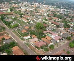
Cristianópolis is a municipality in south-eastern Goiás state, Brazil.
Contents
- Map of CristianC3B3polis State of GoiC3A1s Brazil
- Geographical Information
- Demographic and Political Data
- The Economy
- Health and Education
- History
- References
Map of Cristian%C3%B3polis - State of Goi%C3%A1s, Brazil
Geographical Information
Cristianópolis is in the Pires do Rio Microregion approximately 93 kilometers from the state capital, Goiânia. Highway connections from Goiânia are made by BR-352 / Bela Vista de Goiás. See Distancias Rodoviarias Sepin
Neighboring municipalities are:
Demographic and Political Data
The Economy
The main economic activities were livestock raising, agriculture, and services.
Motor vehicles
Economic Data (All data are from IBGE/Sepin)
Health and Education
The health system had 01 hospital with 23 beds and 02 health clinics (2007). There were 04 schools with 27 classrooms, 51 teachers, and 1,083 students (2006).
Municipal Human Development Index
History
In 1905 Ricardo José do Vale, minister of the Igreja Cristã Evangélica, arrived from Rio de Janeiro, preaching the Protestant faith. In 1906 a farmer who had converted, donated land to build a church, which was built in 1909. Other Protestants arrived from nearby towns and a settlement appeared called Gameleira. In 1927 the name was changed to Cristianópolis. In 1931 the village was raised to the status of district belonging to Santa Cruz de Goiás. Later the district became part of Pires do Rio. In 1944 the Franciscan order bought lands and built a Catholic chapel. In 1953 Cristianópolis became a municipality.