Area 1,865 km² Largest city Slayton | Population 8,533 (2013) Unemployment rate 4.4% (Apr 2015) | |
 | ||
Founded May 23, 1857 (created)1872 (organized) Named for William Pitt Murray, who served in various positions within government Website www.murray-countymn.com Rivers Plum Creek, Champepadan Creek, Des Moines River | ||
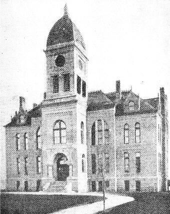
Murray County is a county located in the U.S. state of Minnesota. The population was 8,725 at the 2010 census. Its county seat is Slayton. The county was formed in 1857 and organized in 1872.
Contents
- Map of Murray County MN USA
- History
- Geography
- Lakes
- Major highways
- Adjacent counties
- Demographics
- Census designated place
- Unincorporated communities
- References
Map of Murray County, MN, USA
History
During the 1880s, there was a "war" to decide whether Currie or Slayton would be the county seat.
In the history of record keeping, Minnesota has been struck by two F-5 tornadoes, and both occurred in Murray County: the Chandler-Lake Wilson Tornado (June 16, 1992) and the Tracy Tornado (June 13, 1968) that began in Murray County before crossing north into Lyon County.
Geography
According to the U.S. Census Bureau, the county has a total area of 720 square miles (1,900 km2), of which 705 square miles (1,830 km2) is land and 15 square miles (39 km2) (2.1%) is water. The Mississippi-Missouri watershed divide runs through the western part of the county, near Chandler, along what is locally known as Buffalo Ridge. The highest point is in Chanarambie Township, over 1920 feet above sea level.
Lakes
Major highways
Adjacent counties
Demographics
As of the census of 2000, there were 9,165 people, 3,722 households, and 2,601 families residing in the county. The population density was 13 people per square mile (5/km²). There were 4,357 housing units at an average density of 6 per square mile (2/km²). The racial makeup of the county was 98.34% White, 0.10% Black or African American, 0.22% Native American, 0.21% Asian, 0.02% Pacific Islander, 0.45% from other races, and 0.67% from two or more races. 1.47% of the population were Hispanic or Latino of any race. 47.3% were of German, 12.9% Norwegian, 12.5% Dutch and 5.1% Swedish ancestry.
There were 3,722 households out of which 29.00% had children under the age of 18 living with them, 62.50% were married couples living together, 4.60% had a female householder with no husband present, and 30.10% were non-families. 27.10% of all households were made up of individuals and 15.30% had someone living alone who was 65 years of age or older. The average household size was 2.42 and the average family size was 2.94.
In the county, the population was spread out with 25.00% under the age of 18, 5.90% from 18 to 24, 23.30% from 25 to 44, 24.70% from 45 to 64, and 21.20% who were 65 years of age or older. The median age was 42 years. For every 100 females there were 98.50 males. For every 100 females age 18 and over, there were 97.00 males.
The median income for a household in the county was $34,966, and the median income for a family was $40,893. Males had a median income of $27,101 versus $19,636 for females. The per capita income for the county was $17,936. About 6.30% of families and 8.30% of the population were below the poverty line, including 8.40% of those under age 18 and 9.40% of those age 65 or over.
