
Type sedimentary Overlies Elbrook dolomite | Underlies Beekmantown dolomite Other Dolomite, sandstone | |
 | ||
Sub-units Big Spring Station Member Region Appalachian Basin of eastern North America | ||
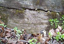
The Conococheague Formation is a mapped Appalachian bedrock unit of Cambrian age, consisting primarily of limestone and dolomite. It occurs in central Maryland, southern and central Pennsylvania, northern Virginia and easternmost West Virginia.
Contents
Depositional environment
The depositional environment of the Conococheague was most likely shallow marine to tidal on a carbonate platform.
Notable Exposures
The type section is located at Scotland in Franklin County, Pennsylvania (northeast of Chambersburg).
Accessible outcrops occur along various roadcuts and waterways in the area, including roadcuts near mile marker 20 of I-70 near Hagerstown, Maryland. The bedding at this site is nearly vertical, with the strike nearly perpendicular to the highway, and thus one can easily walk up and down the sections.
The Conococheague also forms dramatic, 100-foot cliffs along the Potomac River upstream of Shepherdstown, West Virginia (northwest of Harpers Ferry), where entrenched meanders expose mile-long sections of tilted Conococheague strata. These may be easily seen from the towpath trail of the Chesapeake and Ohio Canal National Historical Park along the Maryland bank of the Potomac. In Shepherdstown itself, the top of a Conococheague cliff provides the setting for the monument to steamboat-inventor James Rumsey.
Fossils
Conodonts are present in the Conococheague.
Thrombolites and the possible chiton Matthevia are present in the Boxley Blue Ridge Quarry in Bedford County, Virginia.
Age
Relative-age dating of the Conococheague places it in the Upper Cambrian period.