
Area 1,992 km² Population 69,825 (2013) | Website www.co.bedford.va.us Founded 1754 | |
 | ||
Points of interest Poplar Forest, National D‑Day Memorial, Blue Ridge Mountains, Peaks of Otter, Peaks of Otter Visitor Center | ||
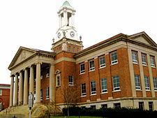
Bedford County is a United States county located in the Piedmont region of the Commonwealth of Virginia. Its county seat is the town of Bedford, which was an independent city from 1968 until rejoining the county in 2013.
Contents
- Map of Bedford County VA USA
- History
- Geography
- Adjacent counties and city
- National protected areas
- State Park
- Major highways
- Demographics
- Board of Supervisors
- Constitutional Officers
- Economy
- Politics
- Attractions
- Town
- Census designated places
- Notable people
- References
Map of Bedford County, VA, USA
Bedford County was created in 1753 from parts of Lunenburg County, and several changes in alignment were made until the present borders were established in 1786. The county was named in honor of John Russell, an English statesman and fourth Duke of Bedford.
Bedford County is part of the Lynchburg, Virginia Metropolitan Statistical Area. As of the 2010 census, Bedford's population was 68,676. The county population has nearly doubled since 1980.
History
The Piedmont area had long been inhabited by indigenous peoples. At the time of European encounter, mostly Siouan-speaking tribes lived in this area.
Bedford County was established by European Americans on December 13, 1753 from parts of Lunenburg County. Later in 1756, a portion of Albemarle County lying south of the James River was added. The county is named for John Russell, the fourth Duke of Bedford, who was a Secretary of State of Great Britain. In 1782, Campbell County was formed from eastern Bedford County and the county seat was moved from New London to Liberty (now Bedford). Also in 1786, the portion of Bedford County south of the Staunton (Roanoke) River was taken with part of Henry County to form Franklin County.
The town of Bedford became an independent city in 1968, and remained the county seat. On September 14, 2011, the Bedford City Council voted to transition into a town, ending its independent city status. The supervisors of Bedford County also voted to accept the town of Bedford as part of the county when it loses city status. The town of Bedford once more became part of Bedford County on July 1, 2013.
Geography
According to the U.S. Census Bureau, the county has a total area of 769 square miles (1,990 km2), of which 753 square miles (1,950 km2) is land and 16 square miles (41 km2) (2.1%) is water.
Adjacent counties and city
National protected areas
State Park
Major highways
Demographics
As of the census of 2000, there were 60,371 people, 23,838 households, and 18,164 families residing in the county. The population density was 80 people per square mile (31/km²). There were 26,841 housing units at an average density of 36 per square mile (14/km²). The racial makeup of the county was 92.18% White, 6.24% Black or African American, 0.20% Native American, 0.43% Asian, 0.01% Pacific Islander, 0.20% from other races, and 0.74% from two or more races. 0.74% of the population were Hispanic or Latino of any race. 28.2% were of American, 15.6% English, 11.0% German and 9.6% Irish ancestry according to Census 2000.
There were 23,838 households out of which 32.50% had children under the age of 18 living with them, 65.40% were married couples living together, 7.50% had a female householder with no husband present, and 23.80% were non-families. 20.20% of all households were made up of individuals and 7.30% had someone living alone who was 65 years of age or older. The average household size was 2.52 and the average family size was 2.89.
In the county, the population's age distribution was: 24.00% under the age of 18, 5.80% from 18 to 24, 29.90% from 25 to 44, 27.50% from 45 to 64, and 12.80% who were 65 years of age or older. The median age was 40 years. For every 100 females there were 99.50 males. For every 100 females age 18 and over, there were 97.50 males.
The median income for a household in the county was $43,136, and the median income for a family was $49,303. Males had a median income of $35,117 versus $23,906 for females. The per capita income for the county was $21,582. About 5.20% of families and 7.10% of the population were below the poverty line, including 8.30% of those under age 18 and 10.50% of those age 65 or over.
Board of Supervisors
District 1: Bill Thomasson (R)
District 2: Curry W. Martin (R)
District 3: Steve Wilkerson (R)
District 4: John Sharp (R)
District 5: Tommy Scott (R)
District 6: Andy Dooley (R)
District 7: Kevin S. Willis (R)
Constitutional Officers
Clerk of the Circuit Court: Cathy C. Hogan (I)
Commissioner of the Revenue: Julie Creasy (R)
Commonwealth's Attorney: Wes Nance (Acting) (R)
Sheriff: Michael J. "Mike" Brown (R)
Treasurer: Rebecca C. "Becky" Jones (R)
Bedford County is represented by Republicans Ralph K. Smith and Stephen D. "Steve" Newman in the Virginia Senate, Independent Lacey E. Putney and Republicans Kathy J. Byron and T. Scott Garrett in the Virginia House of Delegates, and Republicans Robert Hurt and Robert W. "Bob" Goodlatte in the U.S. House of Representatives.
Economy
Historically, Bedford County was an agricultural economy. While agriculture is still an important factor in the county's economy, Bedford County has significant residential development to serve Forest, Lynchburg, Roanoke, and Smith Mountain Lake. Tourism and retail are also becoming more significant with some new industry near Forest and New London.
Politics
*Bedford voted for George Wallace, an Independent for President in 1968.