
Prominence 153 m Elevation 361 m Listing Marilyn | Translation Conic Hill OS grid NS421909 Mountain range Southern Uplands Parent range Southern Uplands | |
 | ||
Topo map OS Landranger 56 and Explorer 364 Similar Ben Lomond, Beinn Chabhair, Cruach Ardrain, Ben Vane, Ben A'an | ||
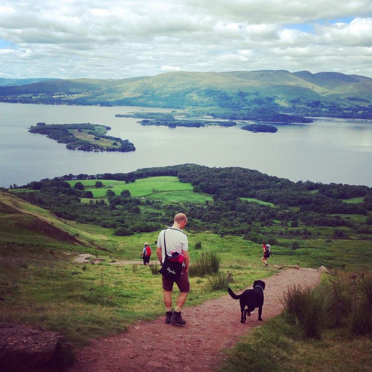
Conic Hill (from Gaelic "coinneach" meaning mossy) is a hill in Stirling, Scotland. It is on the east bank of Loch Lomond, beside the village of Balmaha. It is a sharp little summit which is on the Highland Boundary Fault. From the top, it offers great views over Loch Lomond and towards Glasgow. On a clear day it is even possible to see Goat Fell on the Isle of Arran, which is about 50 miles (80 km) to the south west. In addition, the rounded outline of Ailsa Craig in the Clyde Estuary is sometimes visible.
Contents
- Map of Conic Hill Stirling UK
- Day 2 scottish road trip irvine to inveraray via conic hill 19 03 16
- References
Map of Conic Hill, Stirling, UK
It is accessible for walking, and forms part of the West Highland Way. During the lambing season, dogs are not allowed in the two enclosed fields on the east approach to Conic Hill, even if they are on a lead. The season normally lasts for around three weeks at the end of April and early May. However, this does not affect access with a dog to Conic Hill from the Balmaha direction.
The hill is accessible by public transport, with buses and ferries arriving in Balmaha. There is also a car park at the base, allowing those with own vehicles a place to park before climbing the hill.
In August 2013, 8 members of Deafblind Scotland ascended the hill with help from rangers and guides.