
Length 90.8 km | ||
 | ||
Counties | ||
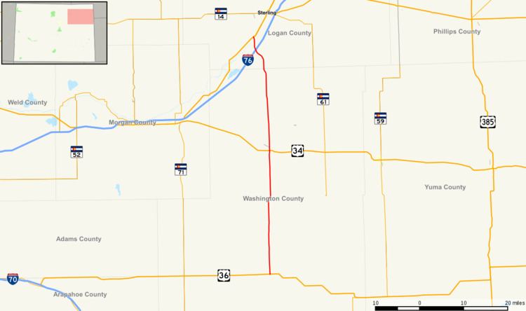
State Highway 63 (SH 63) is a 56.4 mi (90.8 km) long state highway in northeastern Colorado.
Contents
Map of CO-63, Akron, CO 80720, USA
Route description
SH 63 begins in the south at a junction with U.S. Highway 36 at Anton and proceeds north through remote, sparsely populated land for roughly 29 miles (47 km) before reaching a junction with U.S. Highway 34 at Akron. From there, the route continues north for a further 24 miles (39 km) to cross Interstate 76 at that highway's exit 115 and after roughly four more miles arrives at its northern terminus at U.S. Highway 6 in Atwood.
History
SH 63 was defined in the 1920s by the Colorado Department of Transportation, when it connected State Highway 96 in Haswell to Atwood at U.S. Highway 6. A gap appeared near Haswell in 1946. The section was later deleted by 1954, leaving its current routing from Anton to Atwood. This section was paved by 1961.