
Length 54.6 km | ||
 | ||
East end: US 160 east of Chimney Rock | ||
State Highway 151 (SH 151) is a 33.9 miles (54.6 km) state highway in far southern Colorado.
Contents
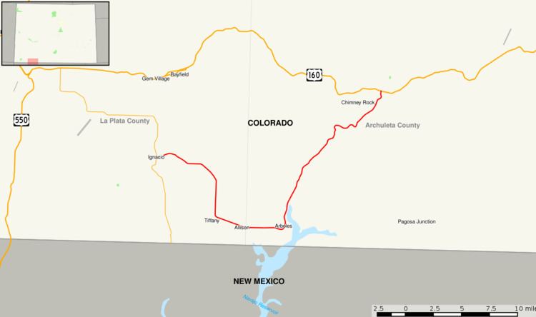
Map of CO-151, Colorado, USA
Route description
SH 151 begins in the west at its junction with State Highway 172 in Ignacio on the Southern Ute Indian Reservation. From there, the road proceeds generally eastward with a southern arc past Allison and through Arboles. The route then turns to the northeast passing near Navajo State Park and across the Piedra River. 25.7 mi (41.4 km) from its western end at Ignacio, SH 151 enters San Juan National Forest through which it continues to its eastern endpoint at U.S. Highway 160 roughly six miles east of Chimney Rock.
References
Colorado State Highway 151 Wikipedia(Text) CC BY-SA