
Elevation 2,764 m (9,068 ft) | Traversed by D 902 road | |
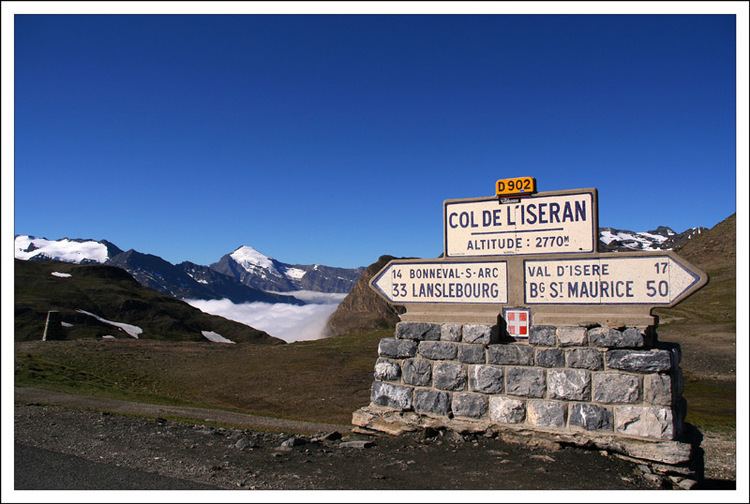 | ||
Col de l'Iseran (el. 2,764 metres (9,068 ft)) is a mountain pass in France, the highest paved pass in the Alps. A part of the Graian Alps, it is situated in the department of Savoie, near the border with Italy, and is crossed by the D902 roadway.
Contents
The pass is part of the Route des Grandes Alpes. It connects the valley of the Isère (Tarentaise) and the valley of the Arc River (Maurienne) between Val-d'Isère in the north and Bonneval-sur-Arc in the south. The north side of the pass road is well built with a number of galleries and tunnels, with a maximum grade of 12 percent.
On the northern side are the popular ski resorts of Tignes and Val-d'Isère.
The pass is only accessible by road during the summer months. In the winter it falls within the Espace Killy ski area and is easily accessed by a series of pistes and ski lifts.
The Col is also accessible by off-road mountain paths and is the highest point both of the Alpine GR5, a long-distance trail from Lake Geneva to Nice, and of the similar Grande Traversée des Alpes. The steep descent to the south, notable for its waterfalls, enters the Vanoise National Park here.
Details of the climb
From the north the road goes up and down and through tunnels past the lake of Tignes. Starting from Bourg-Saint-Maurice, the climb to Col de l'Iseran is 48 km (30 mi). Over this distance, the road (D 902) ascends 1,955 m (6,414 ft), at an average grade of 4.1%. The last 15 km (9 mi) starts at Val-d'Isère and climbs 895 m (2,936 ft) at a consistent average of 6%.
From the south, the climb starts at Lanslebourg-Mont Cenis and is 32.9 km (20.4 mi) in length, ascending 1,371 m (4,498 ft) at an average grade of 4.2%. The final 13.4 km (8.3 mi) starts at Bonneval-sur-Arc and rises 977 m (3,205 ft) at an average gradient of 7.3%, with several sections in excess of 10%.
On both sides of the Col de l'Iseran mountain pass cycling milestones mark the distance to the summit, the current altitude, and the average slope in the following kilometre.
The Tour de France
The Col d'Iseran was first used in the Tour de France bicycle race in 1938. The first rider over the summit was Felicien Vervaecke but on the descent he was passed by Gino Bartali. Bartali had taken the leader's yellow jersey from Vervaecke the previous day and retained it to the finish in Paris.
The first mountain time trial was introduced to the Tour in 1939. It went over the Col d'Iseran from Bonneval-sur-Arc to Bourg-Saint-Maurice and was won by Sylvere Maes by four minutes.
The pass has been used five times on the Tour de France since 1947. It was scheduled to be used in 1996 but was left out at the last minute due to bad weather. As a result of snow on both the Col de l'Iseran and the Col du Galibier the scheduled 190 km (118 mi) stage from Val-d'Isère to Sestriere in Italy was truncated to a 46 km (29 mi) sprint from Le-Monetier-les-Bains. Bjarne Riis claimed the sprint, resulting in him taking the yellow jersey which he retained to the finish in Paris.
Col de l'Iseran was most recently crossed in 2007 in stage 9, which started from Val-d'Isère and went 159.5 km (99 mi) to Briançon on 17 July.