
Traversed by foothpath | Elevation 2,799 m | |
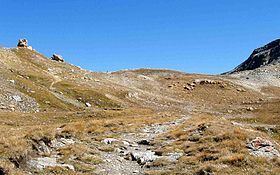 | ||
Col d'Étache in French, (in Italian Colle d'Etiache), is a pedestrian pass (el. 2,799 m) across the Cottian Alps. It connects Susa Valley (Province of Turin, Italy) and Maurienne (Savoie, France).
Contents
Map of Col d'%C3%89tache, 10052 Bramans, France
Geography
The pass is located between mount Gros Peyron (3,047 m, SE) and Cresta San Michele (or Pierre Minieu, 3,252 m, NW). It belongs to the water divide between the drainage basins of Arc and Dora Riparia (thus between Rhone and Po basins).
Hiking
The pass can be accessed from south by a wide foothpath starting from Rifugio Scarfiotti, a CAI mountain hut located in the comune of Bardonecchia at 2,165 m. On the French side the footpath continues until Le Planey, a village of Bramans.
Maps
References
Col d'Étache Wikipedia(Text) CC BY-SA